BRAZIL STATES
- Territory Guide
- BRAZIL STATES
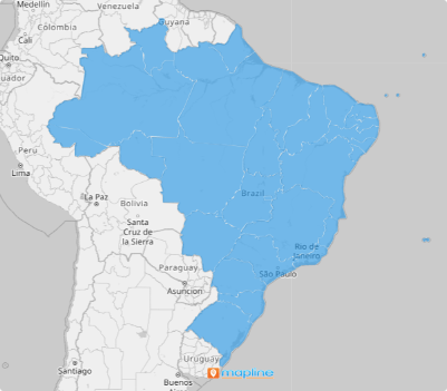
Create your own custom Brazil states map in minutes! In just a few clicks, overlay state boundaries with Mapline.
A Brazil state boundary map offers valuable insights into regional trends, strengths, and business opportunities. By visualizing your data within territory boundaries, you gain a clearer understanding of your business landscape, enabling more informed decision-making.
Ready to elevate your business analysis? Create your own map effortlessly and gain valuable insights into market dynamics and customer demographics specific to each Brazilian state.
WHAT ARE BRAZIL STATES?
Brazil states are the primary administrative divisions within the country, encompassing a wide range of economic, social, and geographic characteristics. Brazil is a federation composed of 26 States.
This type of map offers an advantage in business analytics; for example, a logisitcs company might use a Brazil state map to optimize delivery routes within each state. This would be a great way to enhance efficiency and reduce delivery times. This is just one of the many examples of how a state-level map changes the way you see your data.
ADD BRAZIL STATES TO MAP
It only takes a few seconds to create your Brazil region map!
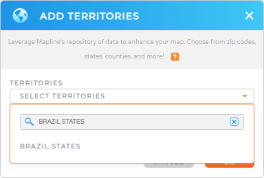
Just add a new territory from Mapline’s repository, then type BRAZIL STATES into search bar. Click on BRAZIL STATES in the drop-down menu and you’re good to go!
Next, let’s check out how to style your territories to get the most out of your data analytics.


Pro Tip: Mapline provides a range of territory boundaries for Brazil. Take advantage of other territories such as mesoregions, microregions, or Sao Paulo zip codes.
CHOOSE STATE COLORS
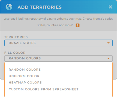
Alright, now let’s select the type of color styling you need for your territories!
Colors are the perfect way to set your data apart and enhance your map’s functionality. Maybe you want every area to be a different color so you can quickly identify different states?
Or maybe you’re looking for a more uniform look?
Once you’ve made your selection, click OK. (You can always update this later if you change your mind).

GET NEW TERRITORY INSIGHTS
That’s just the beginning! Let’s enhance your territory analysis with these powerful capabilities:
- Take your data to a whole new level with demographics
- Save time and money with advanced route optimization
- Get instant access to all the data within each territory with folder reports


