England Ceremonial Counties
- Territory Guide
- England Ceremonial Counties
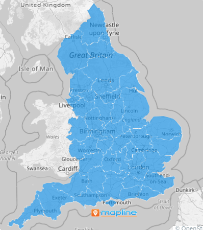
Elevate your territory management game with Mapline’s England Ceremonial Counties! These territories, which encompass both metropolitan and non-metropolitan areas, provide a comprehensive view for analyzing regional data and optimizing business strategies.
Imagine your sales team efficiently targeting customers across these counties, maximizing outreach efforts and driving revenue growth. That’s the power of adding this type of territory boundary to your maps.
WHAT ARE ENGLAND CEREMONIAL COUNTIES?
England Ceremonial Counties are territorial divisions used to denote both metropolitan and non-metropolitan counties in the UK. These divisions can be useful for anyone wanting to get more granular regional insights
For instance, let’s say you’re in a markeing department and you need to optimize your advertising efforts. With this type of map, it’s easy to analyze customer demographics within each county and tailor your promotional campaigns effectively, leading to increased engagement and conversion rates.
ADD COUNTIES
Add these boundaries to your map now! This cutting-edge approach to visualization can empower you to reveal hidden patterns, pinpoint crucial resource gaps, and supercharge your operations with unmatched efficiency.
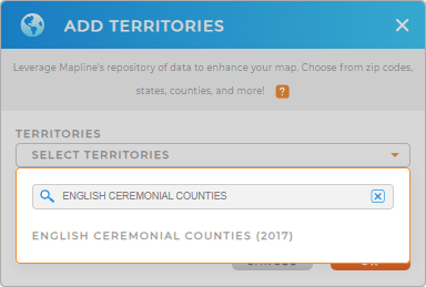
Skip the hassle of manually adding territories and save time with Mapline’s streamlined process. Simply add a new territory from Mapline’s Repository, type ENGLISH in the search bar, and select ENGLISH CEREMONIAL COUNTIES.
Woah! Could that be any easier?


Pro Tip: Mapline’s Repository offers the most up-to-date boundaries available from the Government of the United Kingdom. Explore additional territory options beyond English ceremonial counties, such as England counties, U.K. postcode areas, and U.K. postcode districts to enhance your analytics even further.
CHOOSE COUNTY COLORS
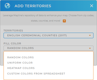
Enhance your territory visualization by customizing county colors to represent different data metrics. Whether you’re analyzing franchise development or demographic trends, Mapline offers various color styles, including random, uniform, custom colors from spreadsheets, or heat map colors, to suit your analysis needs.
Just select the type of colors you’d like to add to your map, then click OK and watch your map transform!

GET NEW TERRITORY INSIGHTS
Revolutionize the way you analyze your territories when you try these capabilities:
- Gain valuable customer insights by applying filters
- Optimize sales visits and service deliveries with route optimization
- Analyze team and individual performance effortlessly with folder reports


