U.S. BLOCKS
- Territory Guide
- U.S. BLOCKS
For many brands, mapping U.S. blocks is a game-changer for understanding diverse communities and driving localized marketing success. These detailed territory maps go beyond pinpointing neighborhood residents—they offer a microscopic view of community dynamics. By integrating the latest U.S. Census block boundaries, you gain up-to-date insights to refine sales territories, execute precise market analyses, and optimize logistics with ease. It’s not just a map—it’s a powerful tool to connect with communities, tailor strategies, and fuel business growth at the hyper-local level!
With the click of a few buttons, watch how your map of U.S. Blocks comes alive and get as many insights from your analysis. Ready when you are, let’s start building your map!
WHAT ARE U.S. BLOCKS?
In the U.S., census blocks are the smallest geographic units designed to capture population potential, offering a granular look at who resides on individual blocks. For brands, block territory maps are invaluable tools for understanding consumer behavior. Add demographic data such as household information, income, and population to your map to unlock powerful insights for precise targeting.
Conduct a block-level analysis by county to uncover fresh ideas for localized marketing campaigns, making your strategies more effective and your connections with communities even stronger.
ADD U.S. BLOCKS
Spend less time adding block boundaries to your map so you can have more time planning for new sales campaigns, enhancing marketing analysis, and selecting the best locations for your future business ventures.
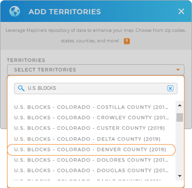
Start by adding a new territory from Mapline’s repository. Use the search bar to search for the U.S. BLOCKS. By default, it will give you all the block territories by county of each state. Choose the county and state you prefer.


Pro Tip: Mapline’s repository has the most recent block boundaries from the U.S. Census Bureau. U.S. Blocks are available by counties of the state.
CHOOSE BLOCK COLORS
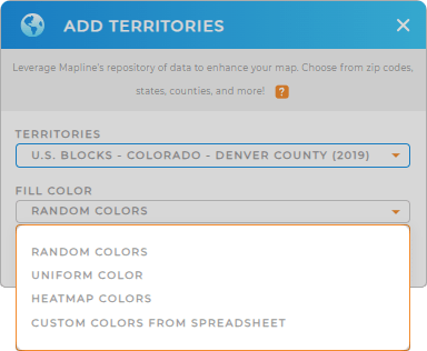
Bring your data to life by customizing the appearance of your territory map! A color-coded territory map isn’t just visually striking—it’s a powerful tool for uncovering deeper insights. By clearly distinguishing areas, you can quickly grasp trends and patterns, empowering you to make smarter, data-driven decisions for your next marketing strategy.
Turn your map into a decision-making powerhouse when you apply the type of colors suitable for your analysis.
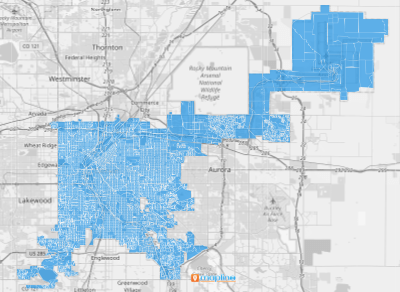
Click OK and you’re done.

GET NEW TERRITORY INSIGHTS
Unlock new opportunities by tapping into the unique potential of each locale within a block. Add these powerful capabilities to your toolkit to gain hyper-local insights that elevate your sales and marketing strategies:
- Efficiently plan sales calls and service visits with optimized routes
- Extend marketing analysis by heat mapping
- Add demographic analysis to your map


