Nigeria Local Government Areas
- Territory Guide
- Nigeria Local Government Areas
Add Nigeria local government areas to your maps and enhance your strategic decision-making with crucial insights into regional demographics, market potential, and distribution networks. LGAs are more than just lines on a map — they’re powerful tools for unlocking growth. When you map your insights within these boundaries, patterns emerge: regional trends become clear, market opportunities shine, and customer clusters reveal themselves.
By visualizing these territories on a map, you can seamlessly integrate local government area boundaries into your mapping solutions, unlocking new opportunities for growth and market expansion. Let’s dive into how it works so you can start making decisions that are driven by location insights.
WHAT ARE NIGERIA LOCAL GOVERNMENT AREAS (LGAs)?
Nigeria boasts a complex administrative structure comprising 36 states and a total of 774 local government areas (LGAs) spread across the country. LGAs serve as fundamental units of governance, responsible for delivering essential services, maintaining infrastructure, and promoting socioeconomic development at the grassroots level.
For brands operating in Nigeria, mapping the country’s diverse LGAs offers invaluable insights for strategic decision-making. By visualizing LGA boundaries on Mapline maps, it’s easier to gain a comprehensive understanding of regional demographics, market dynamics, and consumer preferences. This granular level of analysis enables you to optimize sales operations, marketing campaigns, tailor products and services to local needs, and effectively target key market segments. Ultimately, leveraging LGA mapping capabilities empowers you to establish a stronger foothold in Nigeria, drive customer engagement, and drive sustainable business growth.
ADD LGAs
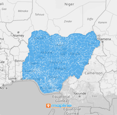
Add Nigeria’s local government areas to your map in a flash and get deeper insights into how these boundaries impact your local operations. Imagine you run a logistics company looking to sharpen your edge. By visualizing how the local government areas are spread across the country, you can fine-tune delivery routes, cut down on travel time, and slash fuel costs — all while boosting efficiency and staying ahead of the competition.
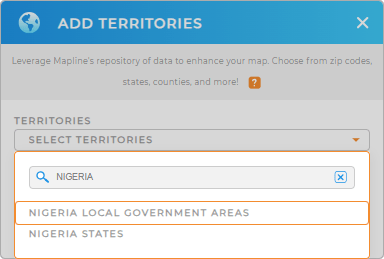
First, add a new territory from Mapline’s repository. Then, type NIGERIA into the searchbar and select NIGERIA LOCAL GOVERNMENT AREAS.
That was easy! Now let’s move on to the next step.


Pro Tip: Tap into Mapline’s worldwide repository of territory boundaries for a wide variety of insights. In addition to local government areas, you can also add Nigeria state boundaries to your maps.
CHOOSE AREA COLORS
Colors are essential for territory analysis! After all, it’s hard to analyze boundaries you can’t see.
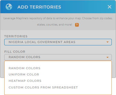
Territories are only useful if you can clearly see them and differentiate between them! Adding colors to your map makes it much easier to hone in on the areas you want to analyze and delve into the type of insights you really need.
Just select the type of color styling you prefer, and you’re all set!
Wow, that was fast! Just imagine what else is possibile with that kind of lightning speed.

GET NEW TERRITORY INSIGHTS
Now, it’s time to unlock the full power of your map! Get started with some of these useful capabilities:
- Organize your data to reveal timely insights
- Create dynamic service coverage maps in seconds
- Filter your data to focus your analysis on the areas that matter the most


