
Overlay Excel Data on a Department Map of Benin
Plot Data From Excel on a Territory Map
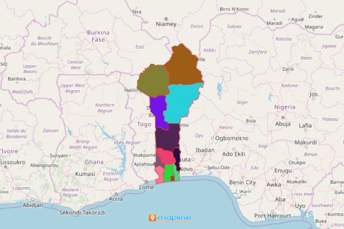
When overlaid with Excel data of locations, a department map of Benin provides insights to improve the production of its resources such as beans, cashew, cassava, cocoa, palm products, peanuts, pineapples, and rice. Formerly known as Dahomey, Benin is a West African country which is divided into 12 departments that are further divided into 77 communes. Currently, these agricultural products are grown for local subsistence. However, when locations are seen on a map, insights float around that can be eventually used for agricultural management.
In Mapline, you have the option to drop location map pins on a Benin Department map either one-by-one or by bulk. You can upload 500 locations for free. Also, Mapline’s repository is packed by thousands of territory boundaries including department boundaries.
Mapping Benin Departments for Powerful Visualization
Add the department territory to your map in seconds. Then use advanced tools like heat maps, or pin and territory customization for more stunning visuals and insightful maps.
- Create a Mapline account and login.
- Click the orange “Add New Items” button.
- Select “New Map” on the drop down arrow.
- Give your map a name and click “OK.”
- Click the “Add” button from the left sidebar.
- Select the “Territories” option.
- Click “From Mapline’s Repository.”
- From the “Territories” select “Benin Departments.” Use the search bar for quicker results.
- Select how you want your boundaries to be colored in “Fill Color” (Random Colors, Uniform Color, Dynamic heat map colors, or Custom colors from spreadsheet).
- Click “OK.”
That’s how easy it is to create a department map of Benin! Mapline also makes it simple to see summary information about the locations inside each department just by clicking on them. Sign up now to build an extraordinary data visualization that makes an impact.