
Botswana District Map Leads to A More Diverse Tourism Economy
District-Level Mapping for Social and Environmental Impacts
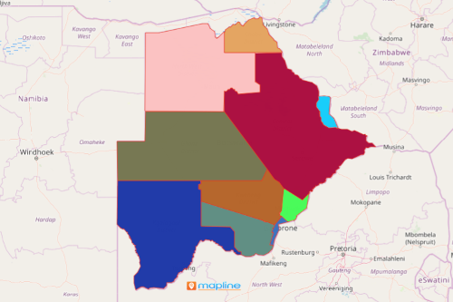
A Botswana district map is critical in managing natural resources in the tourism industry. Botswana is a country located in Southern Africa. Botswana is divided into 16 administrative districts – 9 rural and 6 urban districts. Because of its tourism industry, the country quickly became one of the fastest growing economies in the world. Therefore, it is integral to understand the country at a district level because each district offers potentials in the industry in a much diverse scale.
A district map of Botswana with an overlay of Excel location data points to specific areas for cultural tourism. Applying the network coverage tool is used when looking for the perfect local communities that can be developed for cultural tourism expansion. When district boundaries and location pins are customized, more insights will appear focusing on the potentials of district-based activities for tourism. Some districts may be skilled in traditional crafts, while other districts may have richer natural reserves for bird photography.
Find Out The Best Places on Each District
Create a districts of Botswana map and see the results as your district map lets you find out exactly which local communities can be developed for the tourism economy.
- Create a Mapline account and login.
- Click the orange “Add New Items” button.
- Select “New Map” on the drop down arrow.
- Give your map a name and click “OK.”
- Click the “Add” button from the left sidebar.
- Select the “Territories” option.
- Click “From Mapline’s Repository.”
- From the “Territories” select “Botswana Districts.” Use the search bar for quicker results.
- Select how you want your boundaries to be colored in “Fill Color” (Random Colors, Uniform Color, Dynamic heat map colors, or Custom colors from spreadsheet).
- Click “OK.”
That’s how easy it is to create a Botswana District map! Mapline also makes it simple to see summary information about the locations inside each district just by clicking on them. Sign up now and let us be your partner for planning a more diverse tourism economy.