
How to Maximize The Use of a Region Map of Chad
Experience The Art of Region-Level Mapping
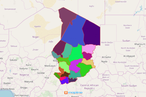
Non-government organizations come to Mapline to create a region map of Chad. Chad is a Central African country which is divided into 23 regions. The regions are further divided into 200 sub-prefectures and 446 cantons. Regions are headed by a governor appointed by the president of the country. A map of Chad regions is integral in many organizations when it comes to understanding, planning, and implementing projects for climate change, economy, education, and health of the country.
The best thing about using Mapline in data and territory analysis is that you get to play with a lot of user-friendly tools that you can really enjoy the art of data and territory analysis. For instance, in just a few seconds, you can overlay Excel data on a region map of Chad. Then you can generate heat maps, customize your location pins, use distance analysis tools, and apply coverage network so you can dig deeper into each region’s boundaries to find many different insights.
Begin with Simple Mapping
Start easy by following these steps. Once generated, you’ll get to notice how powerful the tools are extracting ideas, trends, and patterns for your analysis! You can even share the regions map of Chad or embed it on your website. The map is also an attractive visual and a focal point in any presentation.
- Create a Mapline account and login.
- Click the orange “Add New Items” button.
- Select “New Map” on the drop down arrow.
- Give your map a name and click “OK.”
- Click the “Add” button from the left sidebar.
- Select the “Territories” option.
- Click “From Mapline’s Repository.”
- From the “Territories” select “Chad Regions.” Use the search bar for quicker results.
- Select how you want your boundaries to be colored in “Fill Color” (Random Colors, Uniform Color, Dynamic heat map colors, or Custom colors from spreadsheet).
- Click “OK.”
That’s how easy it is to create a region map of Chad! Mapline also makes it simple to see summary information about the locations inside each region just by clicking on them! Sign up now to gain access to so many other analytical tools!