
How to Manage and Analyze Your Data on a Congo Map Showing Provinces
The Ultimate Solution to All Your Mapping and Analysis Needs
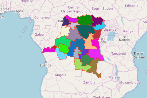
Companies from different sectors overlay their complex Excel data on a Congo map showing provinces not only to gather but more so to manage and analyze their Excel data of locations. Before 1997, the Democratic Republic of Congo was popularly known as “Zaire.” It is the 2nd largest country in Africa by area and the 11th largest country in the world. What is now known as “DRC” consists of 10 provinces and 1 city-province (Kinshasa). The provinces are further divided into 26 districts which in turn are subdivided into communes. The Mapline Solution Suite is an online framework to manage and analyze intricate layers of data. Its powerful mapping tools focus on producing results based on analytical capabilities.
When mapping Excel data on a province map of Congo, the users can customize pins and territory boundaries. They can also generate heat maps to analyze statistics of their geospatial data that produce spatial information. Then, turn into the automate feature to augment their data with the information that they discovered. These are just some of the most important tools used in gathering information and data analysis.
Congo Province Map – More Than Just a Territory Map
When user-friendly analytics are applied, you can analyze everything and think bigger than ever before! But first, brace yourself to the simplest map creation:
- Create a Mapline account and login.
- Click the orange “Add New Items” button.
- Select “New Map” on the drop down arrow.
- Give your map a name and click “OK.”
- Click the “Add” button from the left sidebar.
- Select the “Territories” option.
- Click “From Mapline’s Repository.”
- From the “Territories” select “Democratic Republic of Congo Provinces.” Use the search bar for quicker results.
- Select how you want your boundaries to be colored in “Fill Color” (Random Colors, Uniform Color, Dynamic heat map colors, or Custom colors from spreadsheet).
- Click “OK.”
That’s how easy it is to create a Congo map showing provinces! Mapline also makes it simple to see summary information about the locations inside each province just by clicking on them! Sign up now and see for yourself how you can be benefitted by using the Mapline Solution Suite.