
Use Rwanda Map Showing Provinces for Timely Crisis Response
Learn When, Where, and How to Respond by Mapping Province Boundaries
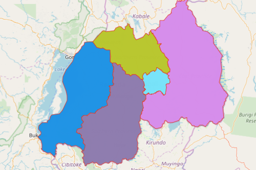
Critical incidents such as droughts, earthquakes, floods, landslides, and windstorms appear in the headlines too often. Thus, studying locations through a Rwanda map showing provinces is the best step to improve the likelihood of survival before, during, and after a disaster. Rwanda is a country stretched between central and east Africa. With its total area of 26,338 km2, it is one of the smallest countries in the African mainland. Rwanda is divided into 5 provinces which are further divided into 30 districts and sub-divided into municipalities.
Mapline designed a platform where government agencies, communities, and operations centers can share location-based data on a Rwanda province map in real time. Customized territories, heat mapped data, and route maps allow the users to understand the complexities, scope, and scale of a crisis. When mapping tools are used for crisis response, it is easier for the community to know where shelters are located thereby ensuring their safety.
Make Crisis Response Your Priority – Build a Map Now!
Don’t worry! It only takes a few seconds to build a province map of Rwanda. Once generated, the map can be shared across government and community agencies to enable coordination and collaboration.
- Create a Mapline account and login.
- Click the orange “Add New Items” button.
- Select “New Map” on the drop down arrow.
- Give your map a name and click “OK.”
- Click the “Add” button from the left sidebar.
- Select the “Territories” option.
- Click “From Mapline’s Repository.”
- From the “Territories” select “Rwanda Provinces.” Use the search bar for quicker results.
- Select how you want your boundaries to be colored in “Fill Color” (Random Colors, Uniform Color, Dynamic heat map colors, or Custom colors from spreadsheet).
- Click “OK.”
That’s how easy it is to create a Rwanda map showing provinces! Once you have your map, you can create a map of Excel spreadsheet locations to overlay on top. Mapline also makes it simple to see summary information about the locations inside each province just by clicking on them! Sign up now to know more about mapping tools that can be used for emergency response.