
Swaziland Region Map Helps to Understand Locations Better
Engage in High-Performing Market Analysis with Region-Level Mapping
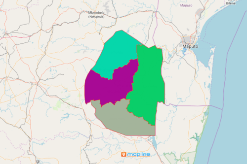
A Swaziland region map is something that marketers and business owners rely on when it comes to market analysis. Swaziland, also called “Eswatini,” is one of the smallest countries in Africa. It is divided into 4 regions: Hhohho, Lubombo, Manzini, and Shiselweni. The country’s economy depends largely on agriculture, forestry and mining. Understanding each region’s boundary is important in monitoring economic growth. Thus, a region map of Swaziland is necessary for decision-making on where to embark new business projects to help the people and communities.
As in most cases, when it comes to high-performing market analysis, organizations often use heat maps. These are mapping tools that use color-coded concentrations to help the users ignite ideas through data visualization. The heat map shows immediate insight into activity levels on each regional boundary.
Steps to Create a Swaziland Regions Map
A few seconds more and you can start your high-performing market analysis with your Swaziland region map! Filter your data so you can identify areas where to focus more. Even better, segmenting your data helps to identify key correlations between regional boundaries and sales trends.
- Create a Mapline account and login.
- Click the orange “Add New Items” button.
- Select “New Map” on the drop down arrow.
- Give your map a name and click “OK.”
- Click the “Add” button from the left sidebar.
- Select the “Territories” option.
- Click “From Mapline’s Repository.”
- From the “Territories” select “Swaziland Regions.” Use the search bar for quicker results.
- Select how you want your boundaries to be colored in “Fill Color” (Random Colors, Uniform Color, Dynamic heat map colors, or Custom colors from spreadsheet).
- Click “OK.”
That’s how easy it is to create a Swaziland region map! Once you have your map, you can create a map of Excel spreadsheet locations to overlay on top. Mapline also makes it simple to see summary information about the locations inside each region just by clicking on them. Sign up now to start engaging in high-performing market analysis!