AMERICAN INDIAN, ALASKA NATIVE, NATIVE HAWAIIAN (AIANNH) AREAS
- Territory Guide
- AMERICAN INDIAN, ALASKA NATIVE, NATIVE HAWAIIAN (AIANNH) AREAS
Tap into a richer understanding of your business landscape by adding a map of American Indian, Alaska Native, Native Hawaiian (AIANNH) areas to your analysis toolkit. This map is a powerful tool for uncovering complex insights with clarity and precision. Harness the power of sophisticated data visualization to uncover hidden patterns, trends, and relationships that traditional data review methods might overlook.
Equipped with these insights, you’ll empower robust strategies that fuel business growth and drive success. Let’s quickly integrate this territory into your maps and level-up your analytics in minutes!
WHAT ARE AIANNH AREAS?
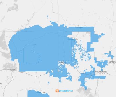
The American Indian, Alaska Native, Native Hawaiian Areas (AIANNH) are designated territories that include federally recognized American Indian reservations, Hawaiian Homelands (HHLs), off-reservation trust land areas, and state-recognized American Indian reservations. For businesses, integrating these boundaries into your mapping strategy offers unparalleled clarity that can transform your operations. Enhance your targeted marketing initiatives and refine your logistical frameworks by incorporating this detailed territorial analysis. For example, distributors can leverage precise location insights to optimize routes, ensuring efficient resource distribution and streamlined delivery services. Let’s dive into creating your map of AIANNH areas and see how they can revolutionize your business approach!
ADD AIANNH AREAS
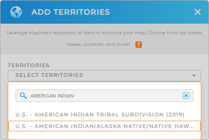
How fast can you add this territory to your map? In just a few seconds! You only have to add a new territory from Mapline’s repository, simply type AMERICAN in the search bar and select U.S. – AMERICAN INDIAN/ALASKA NATIVE/NATIVE HAWAIIAN AREA.
Unlock a competitive edge by visualizing key insights across these regions! Sharpen your decision-making, fine-tune your growth strategies, and connect with local customers on a deeper level.
Woah, that was fast!


Pro Tip: Access Mapline’s worldwide territory for even more administrative and government boundaries inckuding American Indian Tribal subdivisions or Tribal Block Groups.
For data accuracy, Mapline uses terms like ‘American Indian’ in line with the U.S. Census Bureau’s terminology. However, in our communications, we prioritize the preferred nomenclatures of Indigenous peoples to respect their identities. We are committed to honoring the preferences of these communities.
CHOOSE AIANNH COLORS
The next step is to color-code your territory. A color-coded territory map empowers you to visualize key data insights and identify patterns, trends, and outliers at a glance. Let’s say you’re looking for low-performing areas so you can consider potential steps to work on your brand’s presence. Applying dynamic colors is a must!
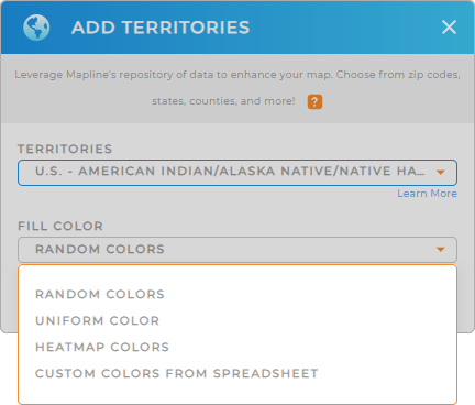
Select your preferred color styling from the options given – random colors, uniform color, heat map, or custom colors. Click OK when you have configured your settings.

GET NEW TERRITORY INSIGHTS
Unlock more possibilities to reveal new location insights hidden in your data with Mapline. Leverage powerful capabilities to enhance your map of AIANNHA:
- Create instant customer and market maps to track your customers’ buying behavior real time
- Track your sales growth in real-time and adjust your strategies promptly
- Sort or filter data to improve data analysis and management


