ALASKA NATIVE REGIONAL CORPORATIONS
- Territory Guide
- ALASKA NATIVE REGIONAL CORPORATIONS
Mapping Alaska Native Regional Corporations unlocks powerful insights, helping you identify trends, optimize operations, and make smarter, region-focused decisions with ease! If you’re a budding entrepreneur looking for ways to improve your sales strategies, start by creating a map with well-defined geographic boundaries especially those that are more granular. Doing so allows you to analyze local demographic trends and grasp local market insights to help you seamlessly craft strategies for your business growth. That’s where Alaska native regional corporation steps in!
Creating a map of Alaska native regional corporations is so easy you’ll be done before you know it.
WHAT ARE ALASKA NATIVE REGIONAL CORPORATIONS?
Under the Alaska Native Claims Settlement Act (ANCSA), Alaska was divided into 12 distinct regions, each represented by a Native association. These associations not only enroll members but also play a pivotal role in regional development.
Adding these regions to your map brings you closer to understanding the unique market dynamics at play. With this granular data at your fingertips, you can tailor your marketing efforts, enhance customer engagement, and steer your business toward unprecedented growth. Let’s get started on mapping these crucial boundaries to unlock new levels of strategic insight!
ADD CORPORATIONS
Analyzing a territory map of the native regional corporations is an intelligent way to refine your sales strategy. Be empowered to identify high-potential areas and pivot your efforts to where they have the most impact! How amazing is that?
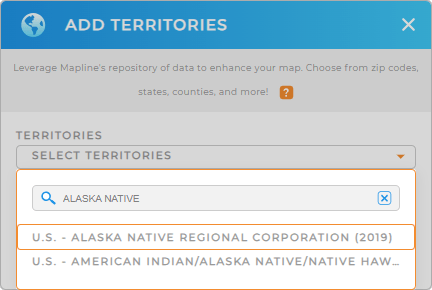
The first step is to add a new territory from Mapline’s repository. In the search bar, simply type ALASKA and select ALASKA NATIVE REGIONAL CORPORATION. Now, let’s move on to the last step.


Pro Tip: For the most recent administrative boundaries available from the U.S. government, select the most recent year from the drop-down menu. Plus, leverage Mapline’s worldwide repository of territories to access other boundaries for Alaska, including AIANNH Areas, Alaska congressional districts, U.S. state legislative districts, and more.
For data accuracy, Mapline uses terms like ‘American Indian’ in line with the U.S. Census Bureau’s terminology. However, in our communications, we prioritize the preferred nomenclatures of Indigenous peoples to respect their identities. We are committed to honoring the preferences of these communities.
CHOOSE REGIONAL COLORS
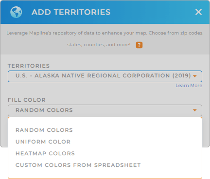
Colors are a great addition for enhanced analysis. Applying static colors to your territories aids in easily distinguishing between regions. But if you want your data to tell stories, apply dynamic colors since they are tied directly to your data. Imagine speeding up your analysis and easily identifying the population density, sales performance, or resource distribution!
Choose your preferred color styling , then hit OK.
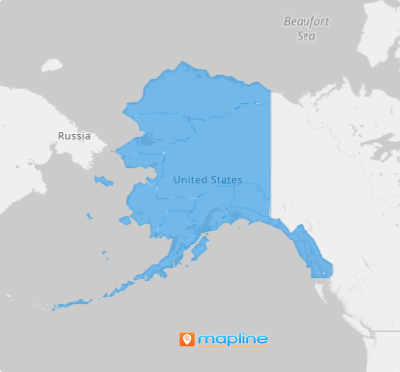
Your map of Alaska native regional corporation is ready to analyze!

GET NEW TERRITORY INSIGHTS
Leverage powerful capabilities to enhance your Alaska native regional corporations map:
- Add receipts, contracts, or images to your data with a file upload button
- Compare competitor locations with Mapline Data
- Add coverage areas to instantly see the geographic reach of your store locations or distribution centers


