
Georgia Municipality Map – An Informative Tool to Keep Constituents Safe
Turn to Georgia Municipality Map to Monitor Constituents
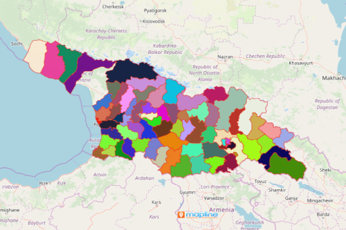
As of March 2021, Georgia has a population of almost 4 million. To monitor the population in the face of the pandemic, a Georgia municipality map should be considered. Step-by-step, Mapline has the perfect tool to use from monitoring the population by municipality, assessing each boundary, and implementation of projects.
Add Excel spreadsheet data of hospitals or health institutions. Then use heat maps to analyze data trends and learn the impacts of the pandemic in each municipality. In addition, Mapline has a tool to help you target specific actions to mitigate risks. Lastly, a municipality-based map can also be shared to team leaders or members of organizations. In this way, the usage of maps can be maximized to extract more insights.
Use Municipality Map to Provide More Contexts and Insights
Just follow these simple steps to create a map.
- Create a Mapline account and login.
- Click the orange “Add New Items” button.
- Select “New Map” on the drop down arrow.
- Give your map a name and click “OK.”
- Click the “Add” button from the left sidebar.
- Select the “Territories” option.
- Click “From Mapline’s Repository.”
- From the “Territories” select “Georgia Municipalities.” Use the search bar for quicker results.
- Select how you want your boundaries to be colored in “Fill Color” (Random Colors, Uniform Color, or Custom Colors From Spreadsheet).
- Click “OK.”
Indeed, maps with municipality boundaries helps to identify new and emerging patterns to keep communities safe amidst the pandemic. Sign up now to utilize more tools to monitor the population’s movements, analyze the economy, and inform the public about safety.