JAPAN CITIES
- Territory Guide
- JAPAN CITIES
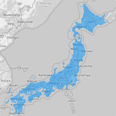
Maximize your business planning as you create a map of Japan cities. Using Mapline, you can create a map in just under a minute! Once done, you can add your data to see connections and relationships between your data and territory boundaries.
How else can you benefit from using this map? Let’s see.
A CLOSER LOOK AT JAPAN CITIES
There are 47 prefectures in the country. Each prefecture is divided into sub-prefectures or municipalities that include cities, towns and villages. There are 1,668 cities in Japan that you can access from Mapline’s Repository. Advance your geographic approach to data analysis as you overlay city boundaries into your map. Get to know the real factors that have major influences in achieving sustainable development goals.
ADD JAPAN CITIES TO MAP
If you’re a business owner wanting to track down the sales performances of your team members, then you’ll be interested with the idea of monitoring their performance in a city-level scope. Look through different angles of each city to identify opportunitie that need to be worked on. Doing a city-level analysis helps you identify new insights that may be hidden if the wrong type of territory is used.
Let’s start by adding territories FROM MAPLINE’S REPOSITORY.
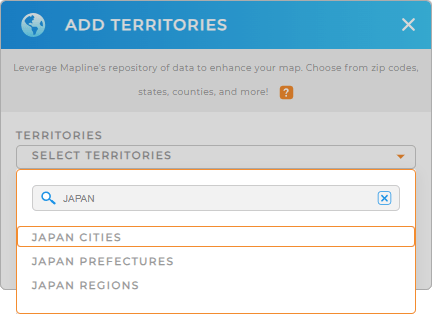
In the search bar, type JAPAN and choose JAPAN CITIES.


Pro Tip: Aside from the city boundaries, Mapline provides other territory boundaries for Japan. You may want to check out the prefecture or region boundaries.
CHOOSE CITY COLORS
You’re almost done. There’s just one important thing that you can apply to your territories to reveal a new look and new insights. That’s adding colors to them.
Colors not only makes your map of Japan cities more attractive. It actually helps to intensify your analysis and capture insights that are relevant to your decision making.
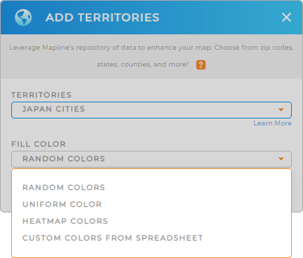
Whatever color style you pick – random, uniform, custom color, or heat map colors – you’ll be delighted that have chosen to assign colors to your territories.

GET NEW TERRITORY INSIGHTS
Turn your map of Japan cities a core system of vital data and territory insights when these capabilities are added:
- Segment your data by customers or locations to find the trends and insights immediately.
- Find communities that are at risk through heat mapping
- Clarify and differentiate locations with labels
That’s super brilliant!


