
Optimize Territory Planning with a Laos Province Map
Map Province Boundaries to Align Territory Analyses
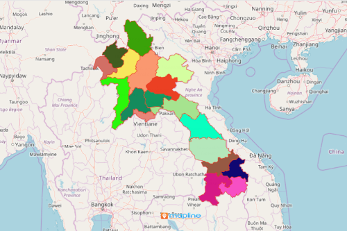
To be successful, most organizations discover that using a Laos province map significantly helps in aligning, balancing, ang optimizing territories. Laos is an Asian country that is divided into 17 provinces. Data analysis done at the provincial level is a sure way to manage each province accordingly. Provincial territory mapping is used in different sectors such as business, manufacturing, heath, and many more. For instance, in the business sector, territory maps are used to identify and analyze individual areas. The insights gained in analyses help create plans to boost sales.
True, at times, territory mapping process may be time consuming. Without the right mapping tools, it may even be confusing. It’s a good thing that Mapline provides the most powerful tools in territory mapping. Optimize your sales territory plans to understand the market, tap new markets, enhance customer connection, and more!
Less Than a Minute to Create a Map of Provinces
Because different sectors rely largely in maps for planning, Mapline makes it the easiest to create a territory map:
- Create a Mapline account and login.
- Click the orange “Add New Items” button.
- Select “New Map” on the drop down arrow.
- Give your map a name and click “OK.”
- Click the “Add” button from the left sidebar.
- Select the “Territories” option.
- Click “From Mapline’s Repository.”
- From the “Territories” select “Laos Provinces.” You can also enter that on the search bar.
- Select how you want your boundaries to be colored in “Fill Color” (Random Colors, Uniform Color, Dynamic heat map colors, or Custom colors from spreadsheet).
- Click “OK.”
Sign up now to have well-defined territory maps. Get to know how maps with boundaries help monitor sales, performances, and deliveries.