
Lebanon District Map – A Significant Help in the Agriculture Sector
Mapping District Boundaries Towards Success
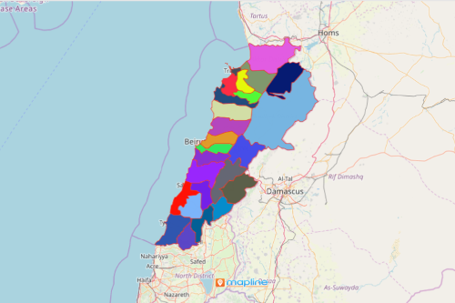
Organizations in the agriculture sector depend largely on a Lebanon district map for data analysis. Why? Because Lebanon has the highest cultivable land in the Arab world. Hence, a district-level map is a significant help to the agriculture sector when it comes to business operations and performance monitoring. When location data are mapped, it shows connections and relationships with each other. When a district boundary is overlaid on a map, it results in a more powerful visual. Thus, territory mapping helps in maximizing productivity, minimizing wastes, and even tapping potential cultivable lands.
Territory planning and analysis may be time consuming. However, with the right mapping tools such as heat mapping, it always leads to the most effective way of properly managing the overall operation of an organization. Avoid the negative consequences of analyzing poorly aligned territories. Use well-defined territories for mapping, such as the Lebanon districts.
District-Level Map Speeds up Data Analysis
A Lebanon district map is easy to create. Once generated, it speeds up your data analysis. It also helps in optimizing and aligning the district territories. Follow these steps to create a map:
- Create a Mapline account and login.
- Click the orange “Add New Items” button.
- Select “New Map” on the drop down arrow.
- Give your map a name and click “OK.”
- Click the “Add” button from the left sidebar.
- Select the “Territories” option.
- Click “From Mapline’s Repository.”
- From the “Territories” select “Lebanon Districts.” You can also enter that on the search bar.
- Select how you want your boundaries to be colored in “Fill Color” (Random Colors, Uniform Color, Dynamic heat map colors, or Custom colors from spreadsheet).
- Click “OK.”
Know more about how Mapline can help your organization with regard to territory planning, alignment, and management. Sign up now!