CANADA CENSUS SUBDIVISIONS
- Territory Guide
- CANADA CENSUS SUBDIVISIONS
Dive into regional insights with a map of Canada census subdivisions!
These subdivisions offer a detailed view of detailed boundaries, enabling you to analyze demographic trends, market opportunities, or regional variations in customer behavior. Whether you’re in sales, marketing, logistics, or operations, mapping census subdivisions allows you to optimize territory management, target specific consumer segments, and make data-driven decisions to drive growth and profitability.
Let’s review how to quickly add these boundaries to your map so you can get down to what matters most for your brand.
WHAT ARE CANADA CENSUS SUBDIVISIONS?
Canada census subdivisions are administrative regions defined by Statistics Canada for census and statistical purposes. While they primarily encompass municipalities, they can also include other areas like Native American reserves or unorganized territories lacking municipal-level governance.
Businesses often leverage subdivision boundaries to gain fresh insights into their customers and operations. For instance, sales teams may pinpoint specific municipalities for market expansion initiatives. By incorporating Canada census subdivisions into a Mapline map, companies can improve decision-making, allocate resources more efficiently, and gain deeper insights into regional differences in customer demographics and preferences.
ADD CANADA CENSUS SUBDIVISIONS
It takes less than a minute to add Canada subdivisions to your map! This is a great way to start analyzing your customers, buying behavior, and market trends that impact your operations.
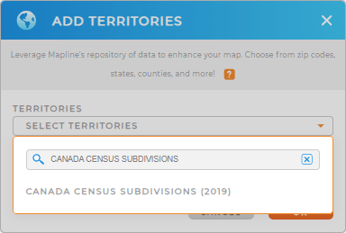
First, add a new territory from Mapline’s repository. Type CANADA CENSUS into the searchbar and select CANADA CENSUS SUBDIVISIONS.
Now that you’ve selected the territory boundary you need, let’s move on to the next step.


Pro Tip: Effortlessly create and manage territories with Mapline’s worldwide repository. It provides an extensive list of territory boundaries in Canada. Check out Canada provinces, Canada census tracts, and Canada population centers for different types of analysis.
CHOOSE SUBDIVISION COLORS
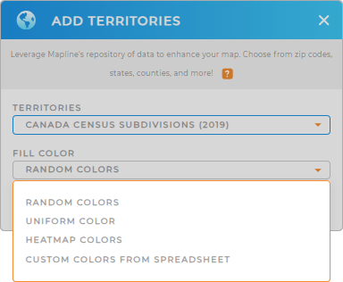
Depending on how you use your subdivion map, you may want different types of color styling for your territories.
For example, maybe you want each individual subdivision to appear a different color for easy identification? Or maybe you’re looking for a more uniform look and prefer a single color.
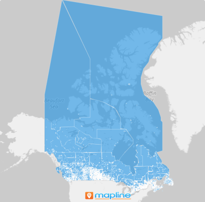
Just select the color styles you prefer, then click OK. And that’s it! Now your map is ready to use.

GET NEW TERRITORY INSIGHTS
Wasn’t that easy? But it doesn’t stop there. Here are some useful ways to speed up your analysis:
- Segment your data to hone in on specific insights
- Work smarter with file column
- Create the most optimized routes possible for your logistics team


