CHINA COUNTIES
- Territory Guide
- CHINA COUNTIES
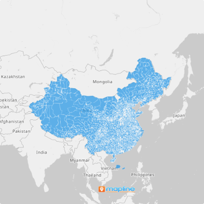
Get ready to supercharge your mapping capabilities with a China counties map! Adding China counties to your map has never been simpler, thanks to our intuitive platform. Whether you’re in logistics, sales, marketing, or any other industry, this feature empowers you to optimize your operations with precision.
Brands in different industries often map China counties. Since the territory boundaries are smaller compared to province and district boundaries, it allows you to view your data in more targeted localities. If you want to penetrate the local market and drive business growth, then county boundaries might be just what you need. Let’s dive in and create your first China counties map!
WHAT ARE CHINA COUNTIES?
China counties serve as third-level administrative divisions within the country, totaling 1,355 in Mainland China alone. These divisions offer a granular view of geographical regions, making them invaluable for businesses seeking localized insights.
Let’s say you’re a retail chain looking to expand your presence in China. By utilizing China county maps in Mapline, you can analyze demographic data and consumer behavior at the county level. This enables you to identify high-potential areas for new store locations based on factors such as population density, income levels, and purchasing trends.
With this targeted approach, you can strategically allocate resources and tailor marketing efforts to specific regions, maximizing the chances of success in each market.
ADD CHINA COUNTIES
Because location is the center of any business, geography really matters. Learning more about the landscape of China’s counties will give you the edge so you can outperform the competition.
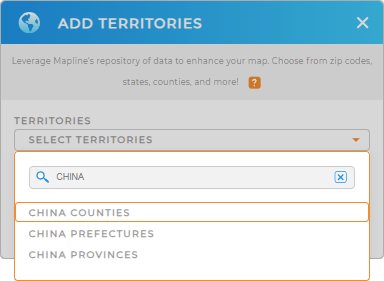
First, add a new territory from Mapline’s Repository. Then type CHINA in the search bar and select COUNTIES.
Woah, that was fast! Let’s move on to Step 2.


Pro Tip: Mapline’s Repository offers a wide range of international territories, including China. Easily access China provinces, China prefectures, and county boundaries to level-up your analysis.
CHOOSE COUNTY COLORS
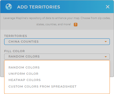
Whether you’re analyzing customer demographic, or business expansion, or customer service improvement, color styles help ignite ideas so you can provide the best solutions to the many challenges affecting your business.
Mapline provides four great color styles to choose from: random colors, uniform color, custom colors from your spreadsheet, and heatmap colors. Choose your preferred color style and watch as your map reveals new insights that supercharge your business strategies!


