HUNGARY REGIONS
- Territory Guide
- HUNGARY REGIONS
Are you looking for ways to gain much success in your business? Then you better start mapping regions of Hungary. Overlay region boundaries into your map to gain timely insights into regional demographics, discover market potentials, and more.
Whether you want to improve your start-up, or evaluating factors for expansion, leveraging region territory maps is a significant key to learn a lot about geographic factors necessary for informed decision-making to drive business growth.
WHAT ARE HUNGARY REGIONS?
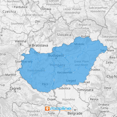
Hungary is a country in Central Europe. It is divided into 7 regions which are further divided into 19 counties. The region boundaries say a lot about location based marketing and operational logistics.
Regions are often used not only in statistical but also in development purposes. Because of that, a growing number of companies are inclined to overlay them on their map for in depth territory analysis. If you’re into sales, assign your sales teams into each region to identify targeted campaigns based on socio-economic and demographic factors. Incorporating the region boundaries into your analysis is a sure way to boost your sales and marketing strategies.
ADD HUNGARY REGIONS TO MAP
In Mapline, we make it so much easier to add territories on your map. In fact, with just a few clicks of your mouse, you can add regions of Hungary from Mapline’s repository. It is especially designed that way so you can focus more on data and territory analysis.
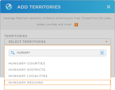
Go to the ADD button on the left side of your map to locate Mapline’s Repository. Then, type HUNGARY into the search bar and select HUNGARY REGIONS from the drop-down menu.
Easy, right? Now, let’s move on to Step 2.


Pro Tip: Aside from the regions, Mapline provides other territories for Hungary – counties, districts, and localities.
CHOOSE REGION COLORS
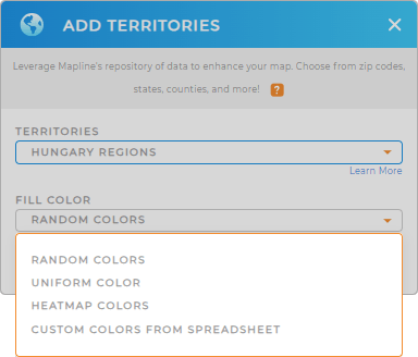
Step 2 is about choosing the colors for your territory. Gain new insights from your map of Hungary regions the moment you incorporate them with custom colors. They serve as a visual guide so you can interpret what your data is saying in a flash.
To choose the right colors for your territory, select the type of color styling from the selections given, then click OK.
With your Hungary regions map ready to go, now you can start your territory and data analysis.


