
Reduce Data Ambiguity by Mapping The Netherlands Municipalities
Municipality-Level Mapping Helps in Identifying Customer Behavior
Business owners, market researchers, and data analysts have one thing in common – they all rely on mapping The Netherlands municipalities as part of business planning. The Netherlands is divided into 355 municipalities. A municipality-level data analysis is a great way to strengthen business and marketing strategies. When Excel data of locations are added on a municipality map, it helps uncover patterns in key data. It also produces great insights on how to strengthen customer connection and engagement.
Since location is integral to any business, adding the locations to a municipality map helps the users gain a better understanding about their customers, potential market, and competitors. Use radial heat maps to see what’s going on in your business network.
Strengthen Customer Connection by Mapping The Netherlands Municipalities
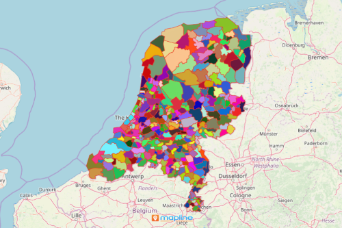
Here’s how easy it is to create a map of municipalities:
- Create a Mapline account and login.
- Click the orange “Add New Items” button.
- Select “New Map” on the drop down arrow.
- Give your map a name and click “OK.”
- Click the “Add” button from the left sidebar.
- Select the “Territories” option.
- Click “From Mapline’s Repository.”
- From the “Territories” select “The Netherlands Municipalities.” You can also enter that on the search bar.
- Select how you want your boundaries to be colored in “Fill Color” (Random Colors, Uniform Color, Dynamic heat map colors, or Custom colors from spreadsheet).
- Click “OK.”
Creating a municipality map is just the start of many more great avenues that are open as you understand your location data. Sign up now and see how much data ambiguity you can reduce while utilizing different powerful mapping tools.