GEORGIA MUNICIPALITIES
- Territory Guide
- GEORGIA MUNICIPALITIES
Unlock the power of local insights by adding Georgia’s municipalities to your Mapline map. Mapping municipalities in Georgia provides businesses with a detailed view for fine-tuning logistics, optimizing service areas, and enhancing market outreach. For brands focused on dispatch, sales, or resource management, municipality mapping offers a closer look at customer density, regional performance, and operational needs. By mapping insights at the municipal level, your team can make precise, data-backed decisions that support growth and operational efficiency.
Let’s explore how mapping Georgia’s municipalities can drive local impact and strategic value for your business!
WHAT ARE GEORGIA MUNICIPALITIES?
Georgia is divided into municipalities, which serve as administrative units responsible for local governance, service management, and regional development. These municipalities are key areas for understanding localized needs and targeting resources effectively. For companies involved in logistics, service delivery, or sales, mapping Georgia’s municipalities enables efficient route planning, targeted marketing, and strategic customer outreach. This municipal view provides the insights needed to align your business activities with specific regional characteristics.
Mapping Georgia’s municipalities empowers your team with localized insights that drive impactful decisions and improve customer satisfaction.
ADD MUNICIPALITIES
Adding Georgia’s municipalities to your Mapline map provides a structured approach to track, plan, and optimize your business activities across local areas. This framework supports improved delivery planning, resource management, and performance tracking.
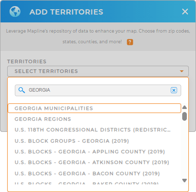
To add this territory, add a new territory from Mapline’s repository, type GEORGIA in the search bar, and select GEORGIA MUNICIPALITIES from the dropdown. Now, you’re ready to analyze data on a municipality-specific level.


Pro Tip: Mapline’s extensive territory repository includes administrative boundaries across countries, giving you access to detailed regional data on a global scale. This is ideal for brands managing multi-region strategies or exploring new market opportunities. Browse our repository to add Georgia boundaries including Georgia regions and municipalities that match your business needs and enhance your data insights.
CHOOSE YOUR COLORS
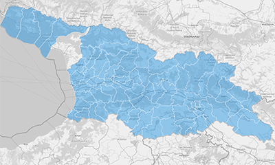
Applying colors to Georgia’s municipalities on your map is a straightforward way to improve data clarity, making it easy to spot trends, identify high-demand areas, and monitor performance. Color-coded municipalities let you interpret regional data quickly and make well-informed decisions.
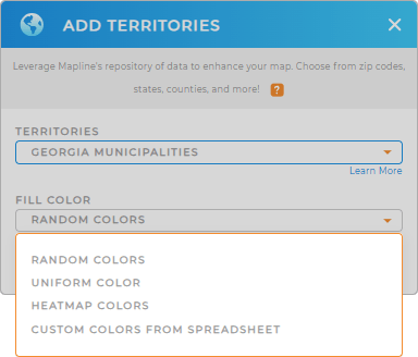
To apply color styling, select your preferred color styling and bring your municipality-level insights into focus.

GET NEW TERRITORY INSIGHTS
Enhance your Georgia municipality map with Mapline’s advanced tools and insights:
- Generate center points to analyze ideal service locations and evaluate proximity across municipalities
- Segment your map locations to categorize customer data, enabling focused analysis and targeted strategies
- Leverage Mapline Data for demographic insights, gaining a deeper understanding of population dynamics in each municipality


