HONDURAS DEPARTMENTS
- Territory Guide
- HONDURAS DEPARTMENTS
When you map your insights across a map of Honduras departments, you unlock a powerful bird’s-eye view of regional trends and opportunities. This perspective reveals new insights that can impact strategic decisions and fuel growth across your business. Whether it’s identifying target markets, tracking performance by location, or enhancing operational efficiency, your map becomes an indispensable tool. With Mapline’s tools, you can dive deep into each department’s unique characteristics and use them to inform key business moves, helping you visualize trends and patterns with precision.
Let’s walk through how to make the most of your Honduras department map. But first, let’s cover the basics of Honduras’s regional landscape.
WHAT ARE HONDURAS DEPARTMENTS?
Honduras, located in Central America, is divided into 18 departments for local administration, each led by a governor appointed by the president to implement central government policies. Since these department boundaries represent the primary administrative divisions, analyzing strategies across them can be a powerful tool for optimizing business operations. This approach helps identify high-activity areas, streamline delivery routes, and uncover untapped market potential.
For example, a department-level map enables precise market clustering, allowing you to identify demand concentrations. By analyzing factors like population density, income levels, and customer bases within these clusters, you can target high-potential areas for expansion and marketing efforts.
ADD DEPARTMENTS
Incorporate Honduras’ department boundaries into your map to transform it into a game-changing analytical tool that drives efficiency and strategic growth. By mapping these departments, you gain valuable insights into regional dynamics that enable you to streamline operations, optimize resource distribution, and target high-opportunity areas. Leveraging these insights not only strengthens your competitive edge but also builds a more resilient, adaptive business poised for long-term success in the market.
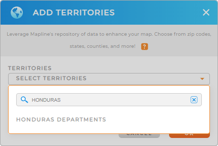
Let’s make this happen as you add a new territory from Mapline’s repository. Then, to cut your time searching for territories, just type HONDURAS into the search bar then click to add HONDURAS DEPARTMENTS to your map.
Easy step, right?


Pro Tip: Access Mapline’s extensive global repository of territories to explore a wide range of mapping options, including Honduras’ departmental boundaries. By leveraging these detailed maps, you can elevate your analytics and gain deeper insights that lead to more informed and effective decision-making.
CHOOSE DEPARTMENT COLORS
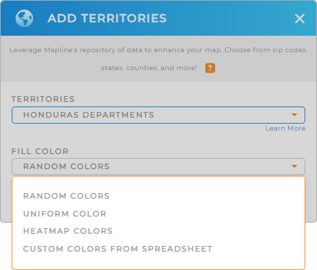
Styling your territories with color styles is a very simple task but leaves a great impact on your analysis and to your audience.
Let’s say you have a coffee production business and you want to expand your delivery services into different departments. You can apply heat map colors to know the concentrations of each department.
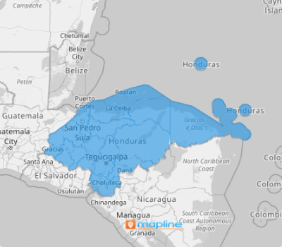
Once you have configured your color setting, click OK and be amazed to view your map of Honduras departments unfold before your very eyes.

GET NEW TERRITORY INSIGHTS
Unlock the full potential of your map of Honduras departments as you apply these advanced features:
- Create routes that optimize themselves in seconds
- Leverage your segments for operational efficiency
- Configure your layer settings for a highly-customizable pop-out bubble


