IRELAND COUNTIES
- Territory Guide
- IRELAND COUNTIES
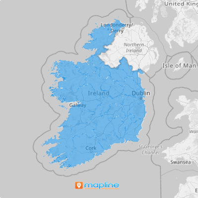
Add Ireland counties to your map in a flash so you can dive deeper into trends, patterns, and insights that signal growth opportunities for your business. Gain instant insights into this detailed county map as you leverage Mapline’s powerful mapping capabilities. County boundary insights allow you to unlock potential and find the right locations for your business or target the right market. With a clear visualization of county boundaries, you can instantly identify fresh insights that enhance your decision-making. Leverage these location-based insights to improve your customer connection and refine your marketing strategies for better brand presence.
Let’s get you started then!
WHAT ARE IRELAND COUNTIES?
Ireland is an island located in the North Atlantic Ocean, in north-western Europe, and is the second-largest island in the British Isles. The eight counties of Ireland are historic administrative divisions that serve as the foundation for local government, planning, and community development. Although the administrative structure has evolved, these traditional counties continue to play a significant role in many aspects of governance and public services. Each county is governed by a county council, which oversees local affairs and implements policies at the regional level.
Since county boundaries give more access to local scenarios, successful brands discover the best places to grow their businesses as they visualize their customer presence, market conditions, and competitive landscapes.
ADD IRELAND COUNTIES
Experiene incorporating county boundaries into your map without any hassle! Adding these detailed boundaries to your map is the first step toward uncovering new insights into the market dynamics. With this level of analysis, you can identify hyper-local opportunities and challenges within each county.
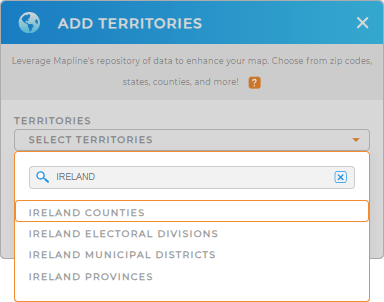
Let’s add a new territory from Mapline’s repository. It’s so simple that you’re done before you know it! Just type IRELAND in the search bar and click to add IRELAND COUNTIES.


Pro Tip: Mapline’s global territory repository offers two options for Ireland counties: IRELAND COUNTIES and IRELAND COUNTIES (2015). If your business requires insights based on historical boundaries—whether for analyzing past market trends, tracking long-term logistical changes, or assessing legacy data—the 2015 boundaries provide valuable context. For current analysis, select IRELAND COUNTIES for the latest administrative layout. Explore our territory repository to find the best boundaries for your analysis.
CHOOSE COUNTY COLORS
When your data gets overwhelming, assigning colors to your territories will keep you focused. It’s a great way to distinguish untapped areas to do business and areas where competition is stiff.
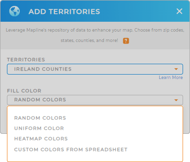
If you want to view your territories by their boundaries with distinct colors, choose random colors. But if you want to emphasize factors with color coding, choose heat mapping colors.
Select the best territory color styles that match your analysis. Once you’ve configured your settings, click OK to finalize the process.

GET NEW TERRITORY INSIGHTS
Want to know what else you can do with your Ireland county map? Check out our other capabilities:
- Announce new promotions when you embed a map to your website
- Check which stores are due for service for the week when you filter your data
- Add network overlays to level up your sales territory management


