NEPAL DISTRICTS
- Territory Guide
- NEPAL DISTRICTS
Add Nepal districts to your map and take your analysis to a district level! A Nepal district map empowers you to quickly uncover trends, anlayze market demand, and optimize your routes. Unlocking the power of detailed regional data helps you drive smarter decision-making and achieve your business goals. This level of precision allows you to tailor your approach, ensuring you stay on the right track and effectively reach your target audience in each district.
Ready to enhance your strategies and skyrocket your ROI? Here’s how to get started!
WHAT ARE NEPAL DISTRICTS?
Nepal is divided into 77 districts, each governed by a local administrative body. These districts play a crucial role in the country’s governance and resource distribution. Mapping these districts allows for precise market analysis, strategic planning, and optimized logistics. By leveraging a map of Nepal Districts, you can focus your efforts on the most impactful regions, enhancing your overall efficiency and performance.
ADD NEPAL DISTRICTS TO MAP
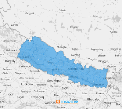
Elevate your analytics with a map of Nepal districts, creating a vibrant and clear representation, helping you make sharper, more informed decisions at a glance.
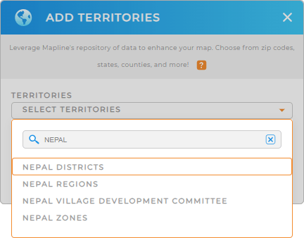
Integrating Nepal Districts into your map in just a few clicks of your mouse! First, add a new territory from Mapline’s repository, and type NEPAL into the searchbar. Select NEPAL DISTRICTS and you’re one step closer to a comprehensive view of regional data in Nepal.
Let’s check out the next step–you’re almost done!


Pro Tip: Mapline’s Repository is packed with territory boundaries from all around the world. Leverage Nepal districts, Nepal regions, Nepal villages, or Nepal zones for even deeper analytics.
CHOOSE DISTRICT COLORS
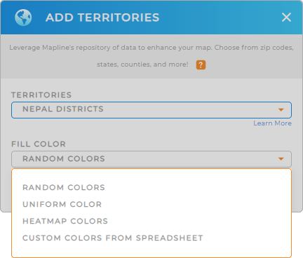
Now, let’s convert your map into a visual powerhouse that allows you to glean new territory insights at a glance. Tailor your map to match your vision with ease. Customize colors to highlight geographical boundaries and values, creating a vibrant, color-coded map that tells your story at a glance.
Just select your desired type of color styling, and click OK.
Now, your critical data points will stand out, streamlining your analytics and decision-making. How awesome is that?

GET NEW TERRITORY INSIGHTS
With your Nepal district boundaries added to your map, now you can focus on analyzing your data. Here are some powerful ways to dive into your data:
- Color-code your locations based on pertinent KPIs or market segments
- View the raw data behind your territories by accessing territory report
- Analyze and segment your audience to quickly spot trends and patterns in your data


