NEPAL ZONES
- Territory Guide
- NEPAL ZONES
Unlock the potential of your business with a map of Nepal zones, providing a clear visual representation to inform strategic decisions. By incorporating Nepal zones into your mapping strategy, businesses gain insights into regional demographics, market trends, and distribution networks. From uncovering growth opportunities to fine-tuning market strategies, adding Nepal zones to your maps empowers you to always be informed, agile, and ahead of the curve in a rapidly evolving business landscape.
Explore the connections between data points and territory boundaries to optimize resource allocation and streamline operations. Start leveraging the power of Nepal zone mapping today to enhance business planning and drive growth.
WHAT ARE NEPAL ZONES?
Nepal was historically divided into 14 administrative zones, forming five development regions. Although the country is now organized into seven provinces and 77 districts, many brands still find it valuable to map these zones for analyzing trends and patterns.
Adding Nepal zones to your map is a fantaistic way to gain valuable insight into regional market dynamics, customer demographics, or distribution networks, particularly for companies operating in sales, marketing, or logistics. By visualizing Nepal zones on a map in Mapline, you can optimize your resource allocation, target specific markets more effectively, and even enhance operational efficiency.
ADD NEPAL ZONES TO MAP
A zone territory map empowers you to foresee challenges and act right away. Doing so can help you uncover opportunities where obstacles once stood.
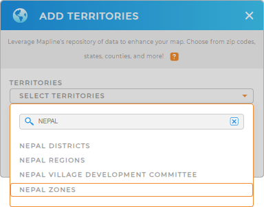
Adding Nepal zones to your map is quick and straightforward with Mapline. First, simply add a new territory from Mapline’s repository. Type NEPAL in the searchbar and select NEPAL ZONES.
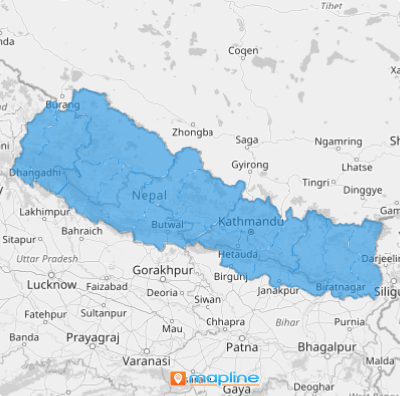
Creating an overlay of Nepal zones is really that easy! There’s just one more quick step before we’re done.


Pro Tip: Mapline’s vast library of territory boundaries lets you seamlessly add regions from around the world to your map, expanding your reach and boosting your logistical edge. Explore, combine, and customize territories to uncover the perfect strategy for your business—and outpace the competition. Tap into our repository and leverage Nepal regions, Nepal districts, or Nepal villages!
CHOOSE ZONE COLORS
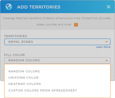
Enhancing your territory boundaries with colors not only improves the visual appeal of your map but also empowers you to make informed decisions. By analyzing color-coded territories, you can identify insights to optimize sales strategies, streamline deliveries, and effectively manage risks.
Just select your desired color styles, then click OK.
Woah, that was fast! Now you can sit back and watch your new territory boundaries appear on your map.

GET NEW TERRITORY INSIGHTS
Now that your map is ready to use, get more insights with the following capabiliites:
- Leverage heat maps to visualize customer density or sales
- Add coverage areas to identify key areas for growth
- Craft spot-on marketing strategies and identify high-potential areas that match your target audience perfectly


