NEPAL VILLAGES
- Territory Guide
- NEPAL VILLAGES
Mapping Nepal villages offers invaluable insights into local demographics, market potential, and distribution networks. Understanding the distribution and concentration of villages can inform targeted marketing campaigns, optimize logistics and supply chain operations, and enhance decision-making for expansion or resource allocation.
Discover the potential of geo-intelligent analytics with a Nepal village map! Let’s delve into the process, empowering you to uncover new avenues for growth and success immediately.
WHAT ARE NEPAL VILLAGES?
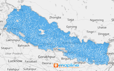
Nestled in the Himalayas, Nepal boasts 481 vibrant villages scattered across its breathtaking landscapes. These villages are the heart of Nepal’s rural communities, characterized by their traditional lifestyle, close community ties, and reliance on agriculture and animal husbandry.
You can leverage Nepal village maps to gain valuable insights into local markets, identify untapped opportunities, and tailor your strategies to resonate with rural populations. For instance, imagine you need to monitor the sales performance of your stores spread across various villages. The most effective approach is to conduct a village-level analysis rather than relying on broader boundaries like provinces or districts. This method instantly unveils insights and ideas that might otherwise remain hidden.
By visualizing village distributions and demographics, you can optimize sales territories, streamline logistics operations, or deliver targeted services to rural areas. There’s no better way to drive growth and foster community engagement!
ADD VILLAGES TO MAP
With Mapline, adding Nepal villages to your map is a breeze—giving you the power to unlock deep insights and drive smarter decisions. If you haven’t used territory mapping in Mapline yet, buckle up. You’re about to be blown away at how quick and easy it is to add new territory boundaries to your map.
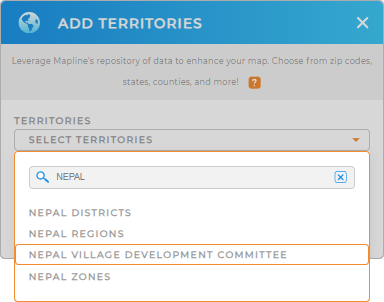
First, add a new territory from Mapline’s repository, then type NEPAL into the searchbar. Select NEPAL VILLAGE DEVELOPMENT COMMITTEE, and you’re all set! Now let’s check out the final step.


Pro Tip: Mapline’s worldwide territory repository offers a vast array of territory boundaries. Explore the Nepal districts, Nepal regions, and Nepal zones to tap into a variety of different insights.
CHOOSE VILLAGE COLORS
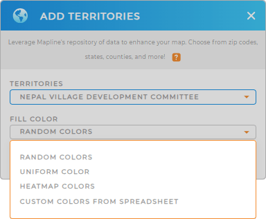
Next, customize your map for the utmost usebility! Adding colors to your map of Nepal villages not only enhances its visual appeal but also empowers you to conduct more in-depth analysis, capturing insights crucial for informed decision-making.
Just select your preferred type of color styling from the drop-down menu, then click OK. And that’s it! Now let’s dive into analyzing your data.

GET NEW TERRITORY INSIGHTS
With your map ready to go, here are some powerful ways to dig deeper into your data and see new trends, patterns, and strategies to drive ROI higher than ever:
- Configure your map to auto-update every time a delivery is made to monitor everything in real-time
- Manage your calendar to keep your operations running at peak efficiency
- View a comprehensive report of the data within your territories


