GUATEMALA DEPARTMENTS
- Territory Guide
- GUATEMALA DEPARTMENTS
There is so much to explore in a map of Guatemala departments, especially when it comes to sugar cane production and its connection with the growing demands for biofuels.
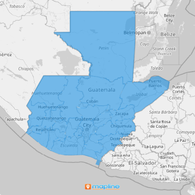
Why not take a minute to create a territory map showing all the department boundaries and overlay your data? You’ll be more than thrilled to know that the location insights you’ll get exceed what you have thought!
But first, let’s find out a little more about Guatemala.
WHAT ARE GUATEMALA DEPARTMENTS?
Located in Central America, Guatemala is divided into 22 departments which are further divided into 335 municipalities.
Do you know that the country has the largest economy in the region? Thanks to its production and export of sugar cane and palm oil, it supports the growing demands for the raw materials needed for biofuels.
A deeper understanding of the department boundaries leads to unparalleled potential for the country in the biofuel industry. Imagine that! So if you’re in this industry, you better brace yourself for a whole new ride of data and location analytics using Mapline’s solutions.
ADD GUATEMALA DEPARTMENTS TO MAP
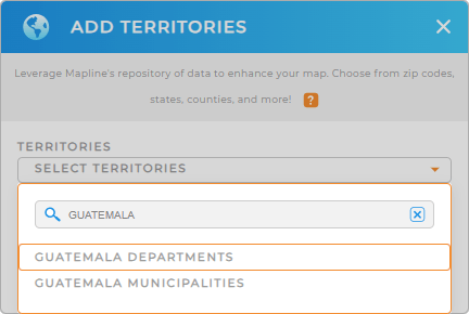
Brace yourself for a whole new ride of data and location analytics using Mapline’s solutions. The first step is to add a new territory from Mapline’s repository. Type GUATEMALA into the search bar and choose GUATEMALA DEPARTMENTS.
When department boundaries are visually presented on a map, you can easily identify sites that have the potential for growing raw materials and the best locations as distribution areas. The routes are also visually clear so you can pinpoint the best routes to cut down delivery expenses and optimize business production.
See? You don’t even realize you’re halfway there!


Pro Tip: You can access the department and municipality boundaries for Guatemala in Mapline’s Repository.
CHOOSE DEPARTMENT COLORS
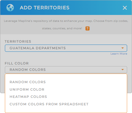
Step 2 is another compelling step to take if you want to enhance your data and location analysis. That is to add color style to your territories .
Go ahead and choose the style that works best for your analysis. If you want to target regions on your map for site selection, you can use static colors. You can also leverage dynamic colors so whenever your datasets update, so do your map territories.
When you have decided on the best color style for your territory, click OK and your map of Guatemala departments is done!

GET NEW TERRITORY INSIGHTS
Mapline is packed with extensive features to help you extract location-based insights to help you be informed in decision-making. Some of them are:
- Transform your map into an informative visual aid when you apply labels
- Get automatic calculations of driving distance with advanced routing
- Leverage Mapline data to explore information from multiple datasets
After applying these functions, we know you’ll never get your eyes off your map of Guatemala departments!


