HAITI DEPARTMENTS
- Territory Guide
- HAITI DEPARTMENTS
Get a clear understanding of Mapline’s Haiti Departments to win your way in business growth. This territory is significant for leaders in the agricultural sector and infrastructure industry.
Buckle up as we take you on a ride to discover patterns and trends, and improve your local understanding of your data and its connection to department territory. Ready when you are, let’s start now!
WHAT ARE HAITI DEPARTMENTS?
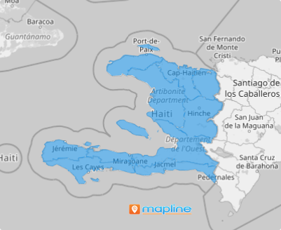
Haiti is located in the Caribbean. It is divided into 10 departments which are further divided into 41 arrondissements, 133 communes, and 570 communal sections.
A closer look at each department says a lot about the target market, trade area, competition, and socio-economic factors that may affect your operations directly or indirectly. To optimize your efforts, have a territory map with you that serves as a system where you can visualize, plan, and execute promptly.
To achieve that, you may want to create a department map.
ADD DEPARTMENTS TO MAP
Adding territories is so easy you can do it in less than a minute. Just click the ADD button on the upper left side of your map to go to Mapline’s Repository.
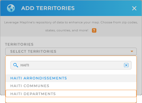
When searching for territories, instead of clicking the drop-down arrow and going through the list, save your time by using the search bar and selecting HAITI. It will trim down the selections. Then click on HAITI DEPARTMENTS.
Is that easy or what?


Pro Tip: Mapline provides 3 territory boundaries for Haiti: Arrondissements, Communes, and Departments.
CHOOSE DEPARTMENT COLORS
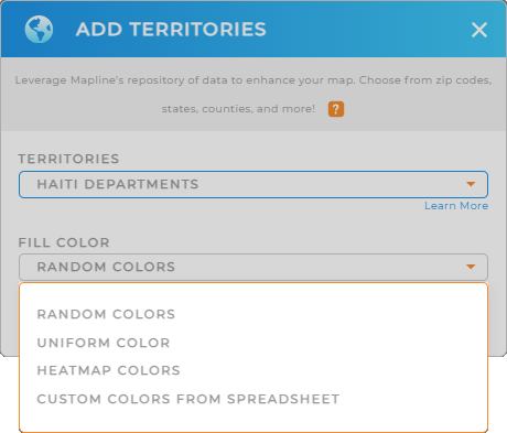
The second step helps you unlock the full potential of your data. We’re not talking about complicated tasks. This step is so easy you’ll be done before you know it! But the visual impact it gives brings a huge input for your decision-making.
We’re talking about adding color styles to your territories. This helps in highlighting specific areas, showcasing production data, or creating a unique visual for your territories.
Once you choose the right color style, click OK and start gathering data and location insights!

GET NEW TERRITORY INSIGHTS
You may want to add these capabilities to explore endless possibilities and insights that you can tap into right now:
- Analyze your data faster than ever when you apply filters
- Calculate actual road miles when you optimize routes for cost-effective outcomes
- Tap into folder reports to effortlessly analyze production and performance on a particular area
With these capabilities and more, take your business to the next level now!


