PHILADELPHIA POLITICAL WARD DIVISIONS
- Territory Guide
- PHILADELPHIA POLITICAL WARD DIVISIONS
Is your map with Philadelphia Ward Divisions accurate? Sure, when you create it in Mapline! We want to make sure that all 1,703 ward division territories are accurately mapped. This is a big help especially in identifying registered voters in each division. Get the many benefits of mapping Philadelphia ward divisions. Analyze special boundaries such as Philadelphia ward divisions to analyze trends and patterns.
Here’s the quickest way to start mapping all political ward divisions in Pennsylvania.
WHAT ARE PHILADELPHIA POLITICAL WARD DIVISIONS?
In the U.S., wards are administrative divisions within cities or towns, often used to organize voting precincts or manage municipal representation. Philadelphia’s ward divisions date back to 1687, making them some of the oldest political subdivisions in the country. The city is organized into 66 wards, each further split into 10 to 50 smaller divisions, each with its own designated polling place. This structure allows for effective local governance and community representation at a very localized level.
With Mapline, you can easily create a Philadelphia Ward Division Map, gaining detailed insights into these boundaries for analysis or planning purposes. Stay tuned for even more ward division territories being added in the future to expand your mapping capabilities.
ADD DIVISIONS TO MAP
Once you overlay territories on your map, you’ll be drawn into insightful observations in no time. These ideas can turn into gems that will help you get a better understanding of the demographics, election planning and operations, and voter outreach.
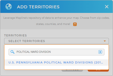
To start off, add a territory from Mapline’s repository so you won’t get sidetracked as you add the ward division territory.
Make sure to type WARD DIVISION in the search bar. It will show the exact territory you’re looking for.


Pro Tip: Mapline’s Repository has the most updated ward division boundaries available from the U.S. Census Bureau. In the state of PA, ward division boundaries are only available in the city of Philadelphia. In addition to ward divisions, you can also add other boundaries for Philadelphia, including Philadelphia council districts and political wards.
CHOOSE DIVISION COLORS
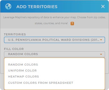
Want to be an effective map storyteller? Then catch the attention of your audience as you choose the perfect color style for your ward division territories! Whether you want to analyze the voting public, the polling sites, or the local political landscape, you’ll never go wrong with custom coloring! The insights that you’ll get lets you embark on highly motivated decisions that bring impact to your organization.
You have color styling options to choose from. Choose the best one that reflects the idea that you want your audience to take in.
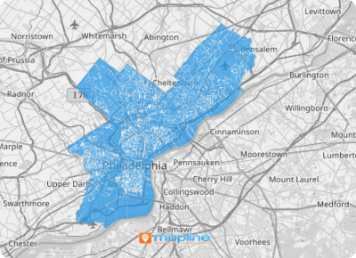
When you’re completely satisfied, click OK and your map is ready to be used.

GET NEW TERRITORY INSIGHTS
The best uses of a map of Philadelphia ward divisions are mainly in electoral purposes such as:
- Determining the most effective order of site visits and onsite inspection of polling places through route optimization
- Applying labels to get to know the committee people and ward leaders
- Acknowledge the voice of future voters as you add U.S. Demographics to your ward division map.


