Brazil Cities
- Territory Guide
- Brazil Cities
Looking for a map of Brazil cities? Look no further!
In Brazil, every city contributes uniquely to economic growth and development. To harness this potential, businesses can analyze their data effectively by creating custom maps of Brazil cities.
Let’s say you want to analyze sales performance across different cities in Brazil. With a map of Brazilian cities, you can easily identify high-performing locations and missed opportunities, or tailor your marketing strategies to specific urban markets.
WHAT ARE BRAZIL CITIES?
Brazil cities are urban areas within the country’s territory, each with its own unique characteristics and economic contributions. These cities play a crucial role in driving economic growth, housing diverse industries, and serving as hubs for commerce and trade.
Mapping Brazil’s cities can offer valuable insights, such as optimizing delivery routes and enhancing operational efficiency. By visualizing the distribution of cities across the country, logistics managers can strategically plan delivery routes,
For example, by analyzing the proximity of major cities and identifying transportation hubs, such as ports and airports, logistics companies can streamline supply chain operations and ensure timely deliveries to customers.
ADD BRAZIL CITIES
Adding Brazil cities to your map is simple with Mapline!
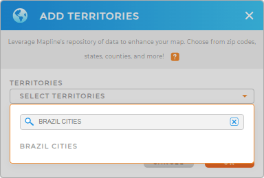
- Add a new territory from Mapline’s Repository
- Type BRAZIL CITIES in the search bar
BOOM! It’s that easy.
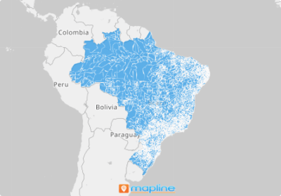
With city boundaries overlaid on your map, you’ll gain valuable insights into the relationship between your data and territories. These geographic insights inform long-term business decisions that benefit your organization.


Pro Tip: There are more than 5,000 cities in Brazil. Fortunately, you don’t need to add them one by one. Just look for BRAZIL CITIES in the repository. Once selected, all the cities appear on your map – in just one click!
CHOOSE CITY COLORS
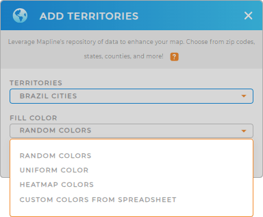
We’re almost there! Now, let’s dive into the fun part – adding colors to your territories!
Is this step really necessary? Absolutely! If you want to understand geographic trends, choosing territory colors is crucial. It’s not just about making your map look good; it’s about telling a story. So go ahead, choose your own color style, and watch how your map comes to life.
Happy with how your Brazil Cities map looks? Then click OK, and you’re all set!

GET NEW TERRITORY INSIGHTS
Take your territory analysis to the next level by incorporating these features into your map of Brazil cities:
- Visualize customer buying behavior by sorting your data
- Gain insights into competitors’ presence with heat maps
- Identify potential gaps in your business coverage areas


