
A Closer Look at The Neighbourhoods of Buenos Aires City Map
Understand The City Better with Neighbourhood-Level Mapping
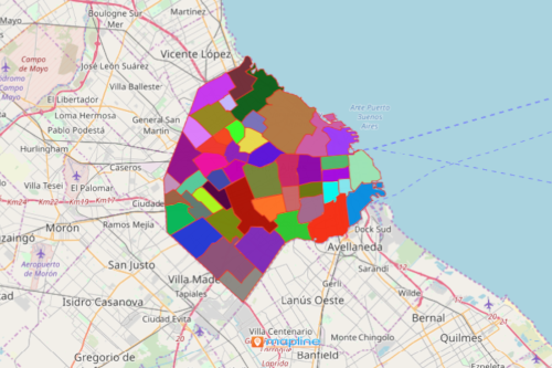
A neighbourhoods of Buenos Aires city map is a great start to really understand the city of Buenos Aires in Argentina. Mapping all the 48 neighborhoods will give you a headstart to understand the largest city and the capital of Argentina. By looking closely at each neighborhood, you will see that each of them has something particularly unique to offer.
Time to Create a Map of Neighbourhood Boundaries Now!
Mapline has a territory boundary of it that you can readily use to build a Buenos Aires City neighbourhoods map.
- Create a Mapline account and login.
- Click the orange “Add New Items” button.
- Select “New Map” on the drop down arrow.
- Give your map a name and click “OK.”
- Click the “Add” button from the left sidebar.
- Select the “Territories” option.
- Click “From Mapline’s Repository.”
- From the “Territories” select “Argentina Neighbourhoods – City of Buenos Aires.” You can also enter that on the search bar.
- Select how you want your boundaries to be colored in “Fill Color” (Random Colors, Uniform Color, Dynamic heat map colors, or Custom colors from spreadsheet).
- Click “OK.”
Sign up now to increase your understanding of the popular city of Buenos Aires.