U.S. TOWNSHIPS
- Territory Guide
- U.S. TOWNSHIPS
A map of U.S. townships does more than just display geographic locations—it reveals the interconnections between regions, helping you uncover hidden patterns and make smarter, data-driven decisions. By mapping your data on this territory map, you can gain granular insights into regional trends, uncover hidden opportunities, and optimize your business strategies. This detailed map helps you identify regional trends in economic performance, consumer behavior, and industry activity. This insight allows you to capitalize on regional strengths and address any weaknesses in your business strategy.
Ready to take your analysis to the next level? Let’s get started and bring your data to life with a map of U.S. Townships!
WHAT ARE U.S. TOWNSHIPS?
In the U.S., a township refers to a small geographic area, but it can be used in several different ways depending on the context. For statistical purposes, the United States Census Bureau classifies towns and townships as minor civil divisions of counties. As of 2002, 16,504 organized township governments were operating across 20 states, including Connecticut, Maine, Massachusetts, New Hampshire, New York, Rhode Island, Vermont, and Wisconsin. There are three primary definitions of a township:
- Survey Township – used to define property locations for deeds and grants
- Civil Township – a unit of local government, often functioning as a civil division of a county
- Charter Township – a special type of civil township found only in Michigan
Understanding the distinctions between these types of townships can provide crucial insights into local governance, geographic organization, and regional dynamics across different states.
ADD U.S. TOWNSHIPS
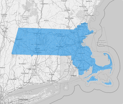
Let’s quickly add township territory to your map. Visualizing these boundaries gives you a clearer understanding of how your business is performing across different regions and helps you make informed decisions about where to allocate resources, expand, or even downsize.
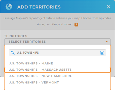
Creating a township map with Mapline is incredibly easy! Just add a new territory from Mapline’s Repository. Type TOWNSHIP and choose U.S. TOWNSHIPS and choose the state. The territory is available in Maine, Massachusetts, New Hampshire, and Vermont.
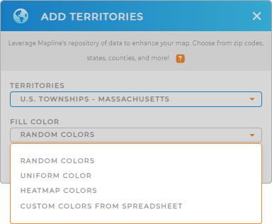
Now, transform your analysis as you apply colors to your map.


Pro Tip: Mapline’s Repository offers the latest township boundaries straight from the U.S. Census Bureau. The township boundaries are available in Maine, Massachusetts, New Hampshire, and Vermont.
CHOOSE TOWNSHIP COLORS
To achieve the perfect balance of visual appeal and data insight, colors are essential. This approach transforms your map into a more engaging and interactive tool, ideal for presentations to clients, investors, or team members.
Apply custom color styling that not only enhances your map’s aesthetic but also improves the clarity of your insights, making the data easier to interpret.
Lastly, click OK.

GET NEW TERRITORY INSIGHTS
It’s time to use these advanced capabilities and get those hidden insights uncovered and bring to the best use:
- Connect aps to Mapline in seconds
- Add demographic data to discover regions with untapped potential
- Quickly visualize sales density around your locations


