U.K. Regions
- Territory Guide
- U.K. Regions
Stay ahead of trends, patterns, and connections by incorporating territories like the U.K. regions into your Mapline map. These regional boundaries provide valuable context for understanding business perspectives, allowing for enhanced location-based analysis. Whether you’re optimizing logistics routes, targeting sales efforts, or refining marketing strategies, having the right territorial framework on your map is key to unlocking actionable insights.
Don’t hesitate—leverage the Mapline advantage today and start building maps that drive smarter decisions!
WHAT ARE U.K. REGIONS?
The U.K.’s administrative landscape is defined by its 12 major regions, encompassing Wales, Scotland, and Northern Ireland as distinct entities, while England is segmented into nine separate regions. These include London, North East, North West, Yorkshire, East Midlands, West Midlands, South East, East of England, and South West. While the English regions no longer hold devolved powers within the government, they serve as vital units for statistical analysis and administrative operations.
These regions offer a structured framework that businesses can leverage to analyze and manage their operations, sales, and marketing efforts. For instance, a logistics company could use U.K. regions to optimize delivery routes, ensuring efficient transportation and timely deliveries across different areas. Incorporating U.K. regions into your Mapline maps offers valuable insights for strategic decision-making and operational planning, ultimately driving growth and success.
ADD U.K. REGIONS
What’s the Mapline advantage? Well, for one, adding territories seamlessly and in seconds. Integrate region boundaries into your maps to align territories with precision—boosting operational efficiency, sharpening focus, and unlocking maximum revenue potential.
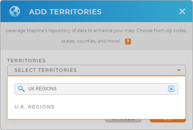
It couldn’t be easier! Just add a new territory from Mapline’s Repository and type UK REGIONS in the searchbar.
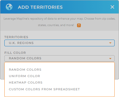
And that’s it! Now you’ve selected the right region–lets move on to the final step.


Pro Tip: U.K. Regions are also called Government Office Regions. They are the highest tier of sub-national divisions in England. You may want to check out other territories from Mapline’s Repository like U.K. postcode areas, U.K. postcode districts, and local authority districts.
CHOOSE REGION COLORS
Let your map do the talking when you assign colors to your territories. Color-coded territories ignite stories that can be readily used for informed decision making.
These stories, when put together, result in creating the next best steps to create business plans, find out economic indicators, and look for new ways to improve marketing strategies.
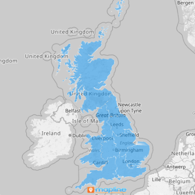
Just select the territory color styles that’s suitable for your analysis then click OK. And BOOM! Now you have your map of U.K. Regions.

GET NEW TERRITORY INSIGHTS
Now, try these other options to add better results (and more fun!) to your analysis:
- Present the right information with map labels
- Perform market research and analysis with coverage areas
- Embed a map on your website to give your audience the most up-to-date information


