URUGUAY CITIES
- Territory Guide
- URUGUAY CITIES
Add Uruguay cities to your map and analyze customer behavior and buying patterns in no time! Leverage your city-wide analysis to obtain crucial insights and fine-tune your strategies to align perfectly with local preferences, unlocking untapped potential. Understanding the patterns and trends in context isn’t just insightful—it’s transformative! It reveals a treasure trove of opportunities, enabling you to craft tailored approaches and foster deeper, more meaningful connections with your customers.
Don’t be overwhelmed. In Mapline, we make mapping simple yet so powerful that it only takes a few seconds to add Uruguay cities. Let’s begin now!
WHAT ARE URUGUAY CITIES?
Uruguay, nestled in South America, is divided into 42 vibrant cities, each representing the smallest administrative units of the country. A detailed map of Uruguay’s cities becomes more than just a tool for many successful brands—it transforms into a powerful hub for location-based analysis, enabling the delivery of timely and impactful information. This kind of insight doesn’t just keep you ahead—it’s the secret weapon that turns challenges into opportunities and ensures your business stays unstoppable!
Make your city map the cornerstone of smart decision-making and drive progress where it matters most!
ADD URUGUAY CITIES TO MAP
With city boundaries clearly mapped, you can swiftly uncover fresh ideas and meaningful connections between your data and territories. Unlock insight revealing innovative solutions for your business right before your eyes.
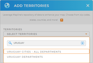
Turn on a lightbulb for smarter decisions and brighter futures as you add a new territory from Mapline’s repository . Type URUGUAY in the search box and choose URUGUAY CITIES.


Pro Tip: Mapline’s robust repository unlocks the power of geographical insights with precise territory boundaries for Uruguay. Dive into detailed Uruguay departments and cities that elevate your analysis, helping you visualize, strategize, and conquer new opportunities with confidence!
CHOOSE CITY COLORS
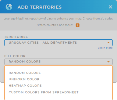
Now, you can understand geographic trends happening in each city by applying territory colors. It’s not about making your map look good. Colors help you identify different factors affecting city dwellers. They make important factors identifiable. Make connections and align your city initiatives with the impending needs of your customers.
Choose the type of colors to bring out important insights that are connected to your data.
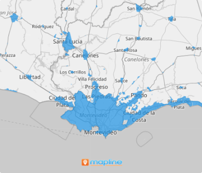
Once done, click OK and see all the location insights from your map of Uruguay cities.

GET NEW TERRITORY INSIGHTS
Adding these capabilities will even help your map tell its own geographic story:
- Visualize routes instantly
- Optimize drive time
- Understand the pain points of your sales and operations through coverage areas


