U.S. STATE LEGISLATIVE DISTRICTS
- Territory Guide
- U.S. STATE LEGISLATIVE DISTRICTS
Searching for an up-to-date map of U.S. State Legislative Districts post-redistricting? Look no further!
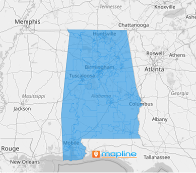
Mapline brings you the latest redistricting territories based on the most recent census data. With just a few clicks, you can easily create a State Legislative District map.
Exciting, right? Let’s explore how this feature elevates your analytics!
WHAT ARE U.S. STATE LEGISLATIVE DISTRICTS?
With Mapline, you can add U.S. State Legislative Districts to your map in moments! These geographical areas within each state are defined based on population and allow residents to vote for their local lawmakers.
Understanding these districts can be essential for businesses. For example, a retail chain considering expansion could use U.S. State Legislative District maps to analyze the political landscape in potential new locations. By understanding the legislative priorities and demographics of each district, the brand can tailor its outreach and advocacy efforts to align with local interests, ensuring a smoother entry into new markets.
ADD LEGISLATIVE DISTRICTS
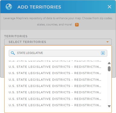
A state legislative district map can help you draw deeper insight empowers you to make smarter, targeted decisions that match the unique needs of each area—fueling stronger results and driving strategic success. Adding U.S. State Legislative Districts a breeze. Simply select territories to add a new territory from Mapline’s Repository, use the search bar, and enter STATE LEGISLATIVE DISTRICTS.
The repository includes both LOWER and UPPER boundaries, so you can easily find the corresponding STATE.
Easy peasy!


Pro Tip: Mapline’s Repository provides the latest U.S. State Legislative boundaries available from the Census Bureau. Select the most recent year from the drop-down to get the most recent boundaries
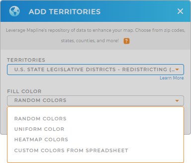
CHOOSE DISTRICT COLORS
Next, visually highlight and categorize specific districts based on relevant criteria. Get at-a-glance insights into key factors influencing your operations styling your territories. Choose the best by color styles in the way that makes the most sense for your business.
Talk about strategic decision-making!

GET NEW TERRITORY INSIGHTS
Now that your map of US State Legislative Districts is up and running, what’s next? Well, it’s only the start of many other amazing insights that you can discover, including:
- Analyze impacts of redistricting to both voters and politicians with U.S. Demographics.
- Understand geographical limitations of constituents in every district with coverage areas.
- Filter and narrow down your data to gain new insights.


