U.S. TRIBAL CENSUS TRACTS
- Territory Guide
- U.S. TRIBAL CENSUS TRACTS
Transform your strategic approach with a detailed map of U.S. tribal census tracts. This specialized territory map enables you to detect emerging trends and fine-grained patterns within tribal areas, giving you a competitive edge in market analysis and decision-making.
Dive deep into the dynamics of tribal regions and harness this knowledge to refine your marketing strategies and operational plans. Are you ready to elevate your data visualization and business intelligence? Let’s explore how to effectively use this unique and insightful territory map.
WHAT ARE U.S. TRIBAL CENSUS TRACTS?
Defined by the U.S. Census Bureau, tribal census tracts are statistical geographic units that encompass small, specific areas within federally recognized American Indian reservations (AIRs). This granularity makes the map an invaluable tool for businesses aiming to deeply understand and engage with local markets on tribal lands.
By integrating a map of U.S. tribal census tracts into your analytics, you can unlock nuanced insights that enhance your sales approaches, marketing campaigns, and logistical frameworks. Let’s leverage this detailed mapping to drive substantial improvements across your strategic initiatives.
ADD CENSUS TRACTS
Whether you’re a startup, a thriving entrepreneur, or a successful business mogul, you’ll never go wrong with analyzing your data on a map of U.S. tribal census tracts. Add this territory to your map and get as many insights as possible to help with your rapid business growth.
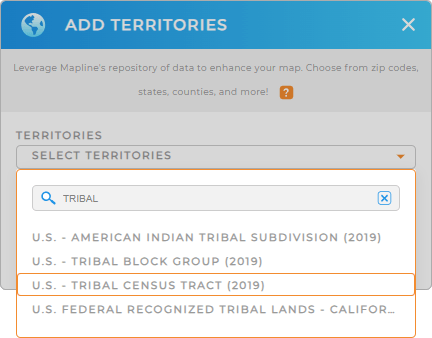
The first thing you need to do to add a new territory from Mapline’s repository is to type TRIBAL in the search bar. It will automatically trim down the selections. Then select U.S. TRIBAL CENSUS TRACTS.
Easy peasy!


Pro Tip: Leverage Mapline’s worldwide repository of territories to access unique boundaries for the U.S. including tribal census tracts, tribal block groups, American Indian Tribal Subdivisions, and more.
CHOOSE CENSUS TRACT COLORS
Now, drill down your analytics even further as you add territory colors. Colors are important factors to differentiate between areas on your map. At a glance, you can identify key data points to easily understand how your data interacts and quickly craft better strategies based on the insights you gleaned.
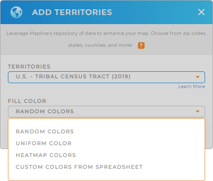
Take the reins and configure your color styles from the options provided – random colors, uniform color, heat map, or custom colors from spreadsheet.
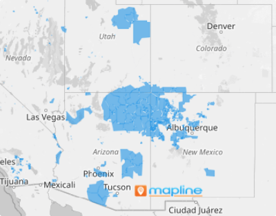
When you’re done, click OK. Now, there’s your map of U.S. tribal census tracts!

GET NEW TERRITORY INSIGHTS
Get ready to raise your head above the competition when you apply these advanced capabilities when analyzing your data on a map of U.S. tribal census tracts:
- Analyze your competitors’ moves to gauge potential threats and opportunities
- Calculate the population inside each tribal census tract boundary for data-driven decision-making
- Create heat maps to visualize customer density


