U.S. URBAN AREAS
- Territory Guide
- U.S. URBAN AREAS
Many organizations want to add U.S. Urban Areas to their maps for market research and analysis. After all, what brand wouldn’t want to focus on areas with a population of 2,500 or more?
If this is what you need, you’re in luck! Mapline offers the most recent urban area boundaries available. Let’s dive in to how to empower your decision-making with rich location data that paints a crystal-clear battle plan for your brand.
Check it out!
WHAT ARE U.S. URBAN AREAS?
U.S. Urban Areas are densely populated regions characterized by significant human activity, infrastructure, and economic development. They encompass cities and surrounding areas with high population density, extensive transportation networks, and various amenities and services typically found in urban environments.
Businesses can leverage these areas to improve operations and optimize everything. For example, a logistics company could leverage a map of U.S. urban areas to optimize delivery routes based on demand. How cool is that?
ADD U.S. URBAN AREAS
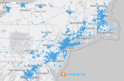
Add U.S. urban areas to your map in seconds! It just takes a few clicks to enhance your location insights.
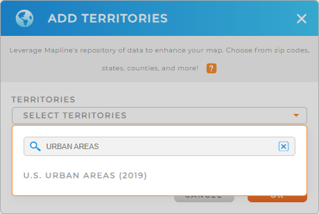
Add a new territory to your map the same way you normally would, then type URBAN AREAS in the search bar.
It’s that easy! Now, let’s move on to your style settings.


Pro Tip: Mapline provides the latest urban area boundaries available from the U.S. Census Bureau. Select the most recent year from the drop-down to get the most up-to-date boundaries.
CHOOSE AREA COLORS
Now, let’s tailor your territory map to convey key insights in a glance.
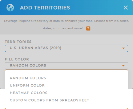
Whether you opt for random, custom, heat map, or custom colors from your spreadsheet, the possibilities are endless. If you’re not already familiar, here’s a quick guide on custom territory colors.
Custom territory styling is a game-changer that elevates your map’s visual impact and makes it easy to communicate invaluable data.

GET NEW TERRITORY INSIGHTS
Now that you’ve added U.S. urban areas to your map, you’re ready to start leveraging new insights. Here are some of the ways other brands use U.S. urban areas to their advantage:
- Structure efficient sales territory plans
- Leverage interactive heat maps to anticipate and mitigate risks
- Sort your data and dive into customer insights that enhance your marketing and sales strategies


