AUSTRALIA STATES & TERRITORIES
- Territory Guide
- AUSTRALIA STATES & TERRITORIES
Gain a strategic advantage by adding Australia states to your Mapline map. Mapping Australia states provides brands with essential insights into regional operations, customer distribution, and market trends, allowing for better decision-making and resource optimization. For companies in sales, logistics, or service management, state-level mapping in Australia supports route optimization, territory planning, and efficient customer engagement. By mapping insights at the state level, your team can fine-tune strategies to match local demand—fueling growth, boosting efficiency, and staying ahead of the competition!
Let’s explore how mapping Australia’s states can elevate your business analysis and decision-making process.
WHAT ARE AUSTRALIA STATES AND TERRITORIES?
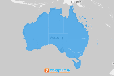
Australia is the home of six states and two territories – each one with its uniqueness.
Sales territories using a map of Australian territories can be a successful sales engine. If you are in real estate and want to explore opportunities in different states and territories, add the state and territory boundaries to your map. Take advantage of every insight you’ll get to increase your brand presence and sales productivity.
ADD TERRITORIES TO MAP
Adding Australia states to your Mapline map creates a structured view of your operations across the country, making it easy to analyze market reach, optimize service areas, and allocate resources effectively. This setup supports companies in managing large territories and planning region-specific strategies.
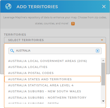
To get started, add a new territory from Mapline’s repository, type AUSTRALIA in the search bar, and select AUSTRALIA STATES AND TERRITORIES from the dropdown.
Your map is now ready to deliver actionable insights based on each state’s unique profile.


Pro Tip: Mapline’s global territory repository includes detailed boundaries worldwide, offering brands the flexibility to map and analyze data across regions. This capability is ideal for businesses with multi-state or international operations looking to optimize their strategies. Browse the repository to find the boundaries including Australia LGAs, Australia localities, or Australia postal codes, that fit your business objectives and maximize your mapping insights.
CHOOSE TERRITORY COLORS
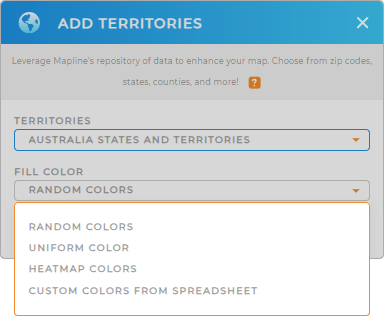
Now try to make your territories more appealing and functional. How? Just add territory color styles! Whether you use your map for presentation, identify sales prospects, or assign territories by sales rep, the right color style helps ignite significant points and ideas to contribute to decision-making.
Choose heat map colors to visualize density in a radius around your pins. You can also go for custom-colored territories if you want to segregate the territories by sales rep. Just choose the best color styles that suits your analysis.
Click OK and you’ll be directed to your map of Australian states and territories.

GET NEW TERRITORY INSIGHTS
Look how easy that was! Now, you have a powerful map of Australia’s territories, giving you the power to:
- Segment your audience within each territory
- Increase efficiency by optimizing each territory’s routes
- Visualize density around your locations with interactive heat maps
- Run new, advanced calculations to pinpoint relationships between your data and territories


