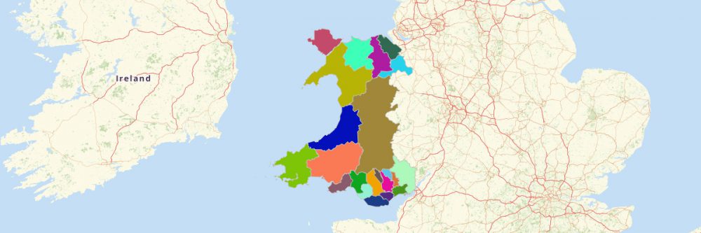
You can easily create a map of Wales Principal Areas using Mapline. Wales is a country that is part of the United Kingdom. The country shares borders with England and lies within the north temperate zone. It has a total area of 20,779 km2 and a population of more than 3 million. Using Mapline, you can easily create a map of Wales Principal Areas. Since 1996, Wales has been divided into 22 principal areas. These areas are used for local government purposes and are responsible for giving provisions of local government services, like education, environment and roads services, and social work.
Steps to Create a Map of Wales Principal Areas
- Create a Mapline account and login.
- Click the orange button “New.”
- Select “New Map” on the drop down arrow.
- Give your map a name and click “OK.”
- Click the “Add” button from the left sidebar.
- Select the “Boundaries” option.
- From the “Boundary Type” select “Wales Principal Areas.”
- Select how you want your boundaries to be colored in “Fill Color” (Random Colors, Uniform Colors, Heatmap on pins inside boundaries, or Paste colors from a spreadsheet).
- Click “OK.”
That’s how easy it is to create a map showing all principal areas in Wales! Once you have your map, you can
create a map of Excel spreadsheet locations to overlay on top. Mapline also makes it simple to see
summary information about the locations inside each principal area just by clicking on them!
Sign up now to create a map of Wales Principal Areas.