GERMAN STATES
- Territory Guide
- GERMAN STATES
Make your map of German states your cornerstone of strategic planning if you really want to experience an uptick in your business. It serves as a central system for data and territory analyses. If you’re a start-up or a thriving entrepreneur, this is the best time for you to get a deeper understanding of state boundaries! Why? Because achieving business growth and success does not rely on just picking up locations wherever you want. It’s about strategic planning.
Mapline’s gonna help you every step of the way beginning with creating your very own map of German states.
WHAT ARE GERMAN STATES?
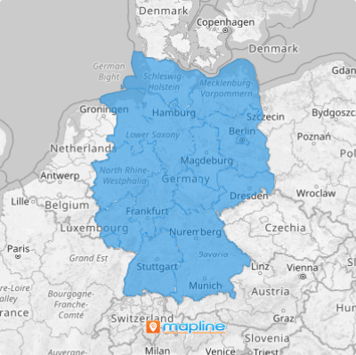
Germany is located in the western-central part of Europe. Germany is recognized for its great contributions in having large portions of specialized small and medium enterprises. Berlin, its capital and one of the 16 states, is a leading location for startup companies and venture capital funded firms.
A territory map of states leads to identify crucial factors for business location analysis which is imperative when starting a small business. It’s a good thing that in Mapline, we can help you create a map of German states in less than a minute!
ADD GERMAN STATES TO MAP
Yes, you read it right. Add a new territory from Mapline’s repository in less than a minute! How is that possible?
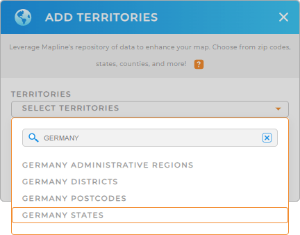
Click the ADD button on the left panel of your map then click FROM MAPLINE’S REPOSITORY. In the search bar, type GERMANY and select STATES.
Once added, be in the know about the opportunities that you may have missed without the state boundaries plotted on your map.
Adding a territory is very important. But the next step is equally important – that of choosing the right colors for your territory.


Pro Tip: Aside from the state boundaries, Mapline also offers other Germany territories that you can readily overlay on your map. These are administrative regions, districts, and postcodes.
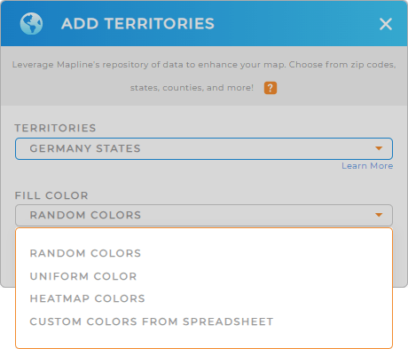
CHOOSE STATE COLORS
Make a visually striking map when you add color styles to your territory. But because you are here in Mapline, having colored territories not only makes your maps attractive. More than that, you get to make your map more informative when you showcase your data. This leads to discovery of time-sensitive information that you may want to address right away.
You can use dynamic colors to know where your customers are. You can also choose static colors to highlight specific regions.
Mapline provides the color styles that best fit your type of analysis. Once you configure the color style, hit OK and that’s it! You have generated a map of German states that easily!

GET NEW TERRITORY INSIGHTS
To enhance your brand visibility, try adding these features:
- Amplify your business insights and make data work for you when you sort your data
- Get the most of your visualizations when you filter your data to extract insights you’re looking for
- Apply coverage areas to visualize factors affecting your business
Start digging in your map now!


