IRELAND COUNTIES
- Territory Guide
- IRELAND COUNTIES
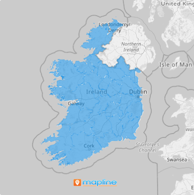
Gain instant insights into the 26 counties of Ireland as you leverage Mapline’s powerful mapping capabilities. How? Map Ireland counties then overlay your Excel spreadsheet data for a deeper dive into trends, patterns, and insights that signal growth opportunities for your business.
County boundary insights allow you to unlock potential in finding the right locations for your business or targeting the right market. Let’s get you started then!
WHAT ARE IRELAND COUNTIES?
Ireland counties are administrative divisions that handle community development, local government, and planning.
Since county boundaries give more access to local scenarios, entrepreneurs and business leaders can discover the best places to grow their businesses as they visualize their customer presence, market conditions, and competitive landscapes.
ADD IRELAND COUNTIES TO MAP
To do that, Mapline makes it easy for you to add county boundaries in seconds! It’s so simple that you’re done before you know it. Just add a new territory from Mapline’s repository.
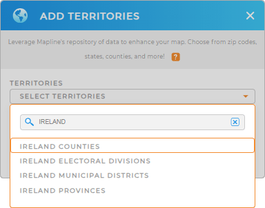
In the search bar, type IRELAND and choose IRELAND COUNTIES.


Pro Tip: In addition to county boundaries, you can access other Ireland territories in Mapline’s Repository including provinces, electoral divisions, and municipal districts.
ADD COUNTY COLORS
Once you’ve selected the right territory, it’s time for you to apply territory colors.
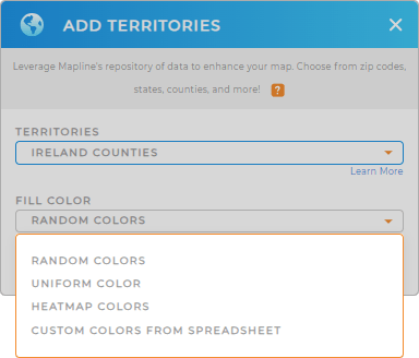
It’s so simple, you’ll be done in no time. If you want to see your territories with distinct colors, choose random colors. But if you want to emphasize factors with color-coding, then you can choose heat mapping colors.
Other color styles are available to enhance your territory analysis. Once you’ve decided which color style to apply, then hit OK and your map of Ireland counties is ready to be viewed.

GET NEW TERRITORY INSIGHTS
Want to know what else you can do with your Ireland county map? Check out our other capabilities:
- Announce new promotions when you embed a map to your website
- Check which stores are due for service for the week when you filter your data
- Add network overlays to level up your sales territory management


