GERMANY STATES
- Territory Guide
- GERMANY STATES
For any business in Germany—whether a budding start-up or a thriving enterprise—a map of Germany states is a powerful asset for strategic planning. Understanding state boundaries and their unique business climates can be the key to unlocking growth and spotting new opportunities. Strategic planning isn’t about setting up shop wherever looks good; it’s about being smart with location choices and tapping into regional advantages.
With Mapline, you have the tools and guidance to create an actionable map of German states that empowers your every move.
WHAT ARE GERMANY STATES?
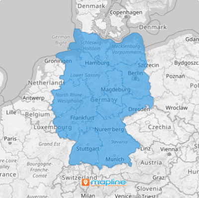
German states, known as bundesländer, form the federal framework of Germany. With 16 states ranging from densely populated North Rhine-Westphalia to innovation hub Berlin, these divisions have significant economic and cultural diversity. Berlin, the capital and a notable state, is a prime hub for start-ups and venture capital, while other regions boast a strong presence of specialized small and medium enterprises.
Mapping these states provides an essential foundation for analyzing market dynamics, competition, and potential business growth in Germany.
ADD GERMANY STATES
Adding state boundaries to your map is more than just layering information; it’s about setting up a strategic framework that helps you make smarter business decisions.
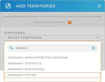
To get started, add a new territory from Mapline’s repository, click the ADD button on the left panel, select FROM MAPLINE’S REPOSITORY, and type GERMANY in the searchbar. Choose GERMANY STATES to add state-level boundaries to your map.
This enables you to clearly see regional market opportunities and challenges that might otherwise go unnoticed.


Pro Tip: Mapline’s repository offers many other worldwide administrative boundaries, including Germany administrative regions, Germany districts, Germany states, and Germany postcodes, letting you analyze your operations from multiple perspectives.
CHOOSE STATE COLORS
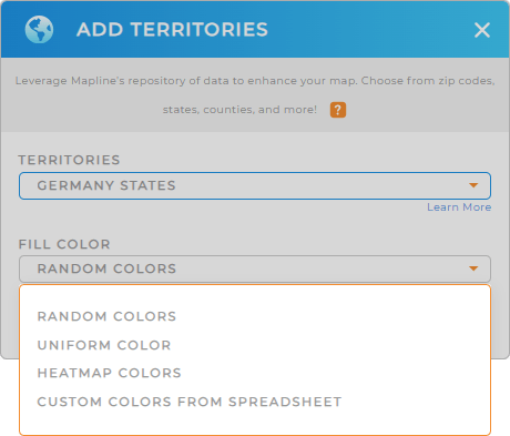
Mapline’s color styles bring your map to life—both visually and analytically. Colors aren’t just about aesthetics; they make your map informative by showing distinctions between different data points and regions. Highlight where your customers are concentrated, or apply color styles to identify high-demand areas, underserved markets, or regions showing growth potential.
Whether you use dynamic colors to track customer distribution or static colors to highlight specific zones, Mapline has customizable color options to fit your analysis needs. Once you’ve applied your color styles, your German states map is ready to work for you.

GET NEW TERRITORY INSIGHTS
Enhance your competitive edge with these Mapline features:
- Segment your data to unlock patterns and trends unique to each state
- Leverage filters to zero in on specific datasets and make pinpointed, data-backed decisions
- Apply coverage areas to visualize service reach and spot new market opportunities


