INDIA SUBDISTRICTS
- Territory Guide
- INDIA SUBDISTRICTS
Add India subdistricts to your map and unlock deeper insights into India’s diverse market landscape! Discover how to leverage Mapline’s powerful mapping tools to incorporate India’s subdistrict boundaries into your analysis.
Gain a granular understanding of local markets, optimize sales territories, and enhance logistical operations. Let’s check out how to get started.
WHAT ARE SUBDISTRICTS IN INDIA?
In India, subdistricts are administrative divisions that represent smaller geographic areas within a district, and can include cities, hamlets, towns, or villages. These sub-districts, also known as tehsils or taluks, play a crucial role in local governance and resource allocation.
Mapping these areas is a fantastic way to identify high-potential markets, target specific customer segments more effectively, or optimize sales territory management. Additionally, understanding the distribution of population and economic activity across sub-districts can aid in logistics planning, allowing you to streamline operations and improve efficiency. Here’s how it works.
ADD SUBDISTRICTS TO MAP
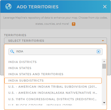
Add precise territory boundaries to your map in seconds! First, simply add a new territory from Mapline’s repository.
Then, type INDIA into the searchbar and select INDIA SUBDISTRICTS from the drop-down.
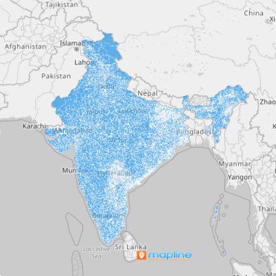
And BAM! You’ve added the right territory boundaries and you’re ready for Step 2.


Pro Tip: Mapline’s worldwide repository offers many different territoy boundaries throughout India. Check out India’s states, districts, or territories to reveal different types of insights based on your brand’s needs.
CHOOSE SUBDISTRICT COLORS
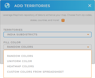
Color-coded territories help you tap into even deeper insights, faster! Analyze the strengths and opportunities of each subdistrict, and identify trends impacting your brand.
Just select the type of colors you’d like to use for your subdistricts, then click OK.
Now, your map is ready for analysis!

GET NEW TERRITORY INSIGHTS
But it doesn’t stop there! Now, you can:
- Access performance reports for each subdistrict
- Filter your data to hone in on the precise insights you need
- Create interactive heat maps that help you pinpoint patterns and trends


