HONDURAS DEPARTMENTS
- Territory Guide
- HONDURAS DEPARTMENTS
When you add your data to a map of Honduras departments, you’ll get a comprehensive view of the connection between your data and their corresponding boundaries. The insights you’ll gain can significantly affect your decision-making for your business growth.
In Mapline, we’ll take you through every step to make it possible. But first, let’s find out what’s in it for you about this department territory.
WHAT ARE HONDURAS DEPARTMENTS?
Honduras is an agricultural country located in Central America. It is divided into 18 departments. These departments play a vital role in agriculture, the country’s leading economy. As a leader in this industry, you want to get ahold of a detailed territory map of Honduras departments to be a game changer for your brand.
Make your map work for you as you visualize, analyze, and plan accordingly from the location insights you extract.
Let’s start with Step 1.
ADD HONDURAS DEPARTMENTS
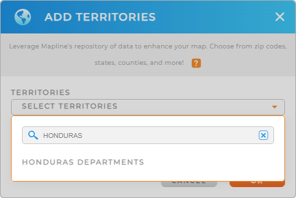
Step 1 is about getting access to Mapline’s Repository. To do that, you need to click the ADD button found on the left side of your map,
Cut your time searching for territories when you simply type HONDURAS to the search bar. It will automatically show HONDURAS DEPARTMENTS. Just click it to add to your map.
Easy step, right?
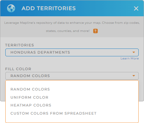
There’s one other thing before you click OK and that’s to choose a fill color.


Pro Tip: Leverage the Honduras departments territory map as your one-stop system of engagements to visualize, analyze, share, plan, and implement agricultural management programs.
CHOOSE DEPARTMENT COLORS
Styling your territories with color styles is a very simple task but leaves a great impact on your analysis and to your audience.
Let’s say you have a coffee production business and you want to expand your delivery services into different departments. You can apply heat map colors to know the concentrations of each department.
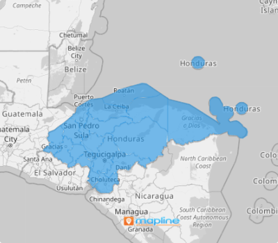
Once you have configured your color setting, click OK and be amazed to view your map of Honduras departments unfold before your very eyes.

GET NEW TERRITORY INSIGHTS
Unlock the full potential of your map of Honduras departments as you apply these advanced features:
- Create routes that optimize themselves in seconds
- Leverage your segments for operational efficiency
- Configure your layer settings for a highly-customizable pop-out bubble
See these all in action now!


