U.S. Consolidated Cities
- Territory Guide
- U.S. Consolidated Cities
Discover patterns and trends that transcend state boundaries by incorporating the distinctive territory boundary of U.S. consolidated cities into your Mapline maps. With Mapline’s intuitive interface, adding this boundary is simpler than ever. Gain deeper insights into urban landscapes, streamline logistics planning, or target marketing campaigns with precision by leveraging this unique territorial perspective.
Ready to unlock new insights? Let’s dive in and add U.S. consolidated cities to your map today!
WHAT ARE U.S. CONSOLIDATED CITIES?
A U.S. consolidated city refers to a unique local government structure where one or more cities merge with the surrounding county or parish to form a unified jurisdiction. This consolidated entity possesses the combined governmental powers of a municipal corporation and a county.
For businesses using Mapline, incorporating boundaries of U.S. consolidated cities into maps can provide valuable insights. For example, logistics companies can optimize delivery routes by understanding the geographic layout of these consolidated areas, while sales and marketing teams can target their efforts more effectively by analyzing population density and demographic data within these jurisdictions.
By leveraging the boundaries of U.S. consolidated cities, businesses can make informed decisions and streamline their operations for greater efficiency and success.
ADD CITIES TO MAP
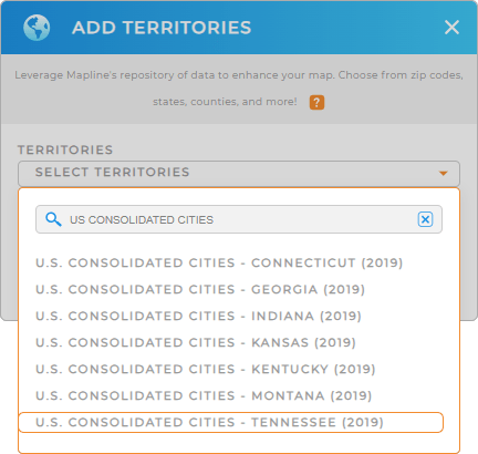
To get started with your city-level analysis, you’ll first need to add a new territory from Mapline’s repository.
Next, type U.S. CONSOLIDATED CITIES into the searchbar to reveal all the states that have consolidated city boundaries. Select your desired area, and you’re good to go!
Now let’s check out how to make your territories easy to use on your map.


Pro Tip: Mapline provides the latest U.S. consolidated city boundaries available from the U.S. Census Bureau. U.S. consolidated city boundaries are available in CT, GA, IN, KS, KT, MT, and TN. Select the most recent year from the drop-down to get the most recent boundaries.
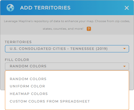
CHOOSE CITY COLORS
Why is it important to add colors to your map? Because a color-coded map reveals new insights that are key to data-driven decision making.
Just select the type of color styling you need, and you’re good to go!
What, that’s it? Woah, that was fast! Now, let’s dive in and discover how to get the most from our new territory boundaries.

GET NEW TERRITORY INSIGHTS
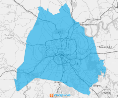
Now that you have a map showing all the U.S. CONSOLIDATED CITIES, you can start:
- Share your map with your team and keep everyone up-to-date
- Quickly access a folder report of the data within your territory
- Add U.S. Demographic data to see trends between your customers and territories


